Zolota Lypa

Zolota Lypa

48° 58′ 53″ N 25° 04′ 20″ E / 48.9814, 25.0722

Zolota Lypa
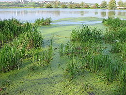
Lac formé par la Zolota Lypa au nord de Berejany
Caractéristiques
Longueur 85 km
Bassin 1 310 km2
Débit moyen  ?
Cours
Se jette dans le Dniestr
Géographie
Pays traversés Drapeau d'Ukraine Ukraine

La rivière Zolota Lypa (en ukrainien : Золота Липа ; en polonais : Złota Lipa) est un cours d'eau d'Ukraine et un affluent gauche du Dniestr.

La Zolota Lypa arrose l'oblast de Ternopil, dans l'ouest de l'Ukraine. Elle est longue de 85 km et draine un bassin de 1 310 km2.

La Zolota Lypa alimente un lac de 130 ha au nord de la ville de Berejany. Le château de Berejany se dresse sur une île dans la rivière.

En ukrainien et en polonais, Zolota Lypa signifie « tilleul doré ». Une autre rivière, la Hnyla Lypa, dont le nom signifie « tilleul pourri », suit un cours parallèle, 30 km à l'ouest de Berejany.


Wikimedia Foundation. 2010.

Contenu soumis à la licence CC-BY-SA. Source : Article Zolota Lypa de Wikipédia en français (auteurs)

Игры ⚽ Поможем написать курсовую

Regardez d'autres dictionnaires:

  • Zolota Lypa — Sp Zolotà Lýpa Ap Золота Липа/Zolota Lypa L u. V Ukrainoje …   Pasaulio vietovardžiai. Internetinė duomenų bazė

  • Zolota Lypa River — Zolota Lypa ( uk. Золота Липа , pl. Złota Lipa) is a river in western Ukraine. It flows through Berezhany district, forming the large Berezhany lake north of Berezhany. It is the tributary of Dniester, belonging to the Black Sea basin. Zolota… …   Wikipedia

  • Hnyla Lypa — 49° 07′ 14″ N 24° 45′ 17″ E / 49.1206, 24.7546 …   Wikipédia en Français

  • Hnyla Lypa — ( uk. Гнила Липа , pl. Gniła Lipa) is a river in Ukraine. Hnyla Lypa means a rotten linden tree both in Polish and Ukrainian. It is a tributary of the Dniester river, and runs parallel to the Zolota Lypa river. Some of the towns it runs through… …   Wikipedia

  • Dniester Canyon — (Дністровський каньйон) National Park Dniester landscape in West Ukraine …   Wikipedia

  • Berejany — Бережани Géolocalisation sur la carte : Oblast de Ternopil …   Wikipédia en Français

  • Золота Липа — Sp Zolotà Lýpa Ap Золота Липа/Zolota Lypa L u. V Ukrainoje …   Pasaulio vietovardžiai. Internetinė duomenų bazė

  • Dniestr — 46° 21′ 00″ N 30° 14′ 00″ E / 46.35, 30.2333 …   Wikipédia en Français

  • Dniester — Nistru redirects here. For the village in Maramureş County, Romania, see Tăuţii Măgherăuş. Nistria redirects here. For the village in Neamţ County, Romania, see Boghicea. Dniester, Dnister, Nistru Дністер …   Wikipedia

  • Costoboci — Map of Roman Dacia showing Costoboci to the north. The Costoboci (Latin: Costoboci, Costobocae, Castabocae, Coisstoboci, Ancient Greek: Κοστωβῶκοι, Κοστουβῶκοι or Κοιστοβῶκοι[1]) were an ancient people located, during the Roma …   Wikipedia

Share the article and excerpts

Direct link
Do a right-click on the link above
and select “Copy Link”