- World Ocean Atlas
-
Le World Ocean Atlas (Atlas de l'océan mondial) est un produit du National Oceanographic Data Center (États-Unis) qui dépend de la NOAA. Il est constitué de données climatologiques in situ pour l'océan planétaire. Sa première publication a lieu en 1994[1] (basé sur le précédent Climatological Atlas of the World Ocean[2]), et est réédité à des intervalles d'environ quatre ans : 1998[3], 2001[4] et 2005[5]. Il existe également des produits du même genre distribués par le centre de données CORIOLIS[6] (France). Les climatologies WOA utilisent toutes les données disponibles depuis le début des mesures thermohalines de l'océan, or les climatologies sont utilisées comme valeurs moyennes d'un paramètre en un jour de l'année à un point géographique donnée et le fait qu'il existe des tendances inter-annuelles sur certains paramètres physiques (par exemple la température) fait que le choix de la période utilisée pour produire la climatologie peut avoir des répercussions importantes.
Sommaire
Galerie
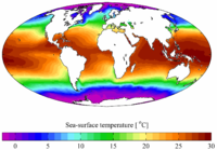 Moyenne annuelle en surface de température (WOA 2001)
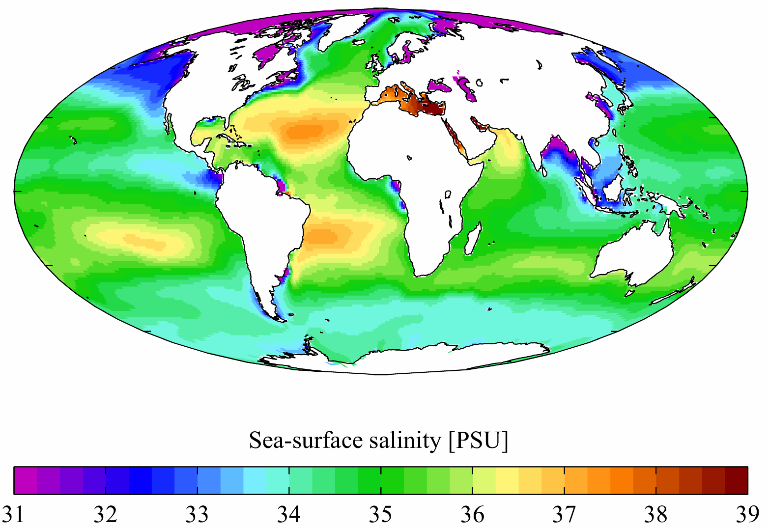
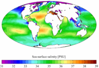 Moyenne annuelle en surface de salinité (WOA 2001)
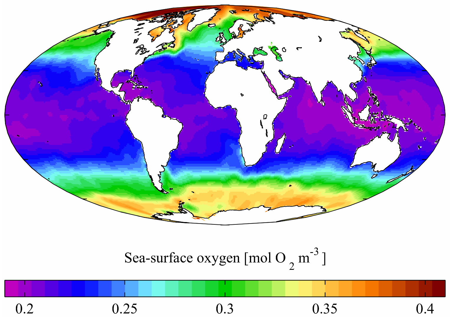
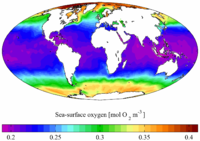 Moyenne annuelle en surface d'oxygène dissout (WOA 2001)
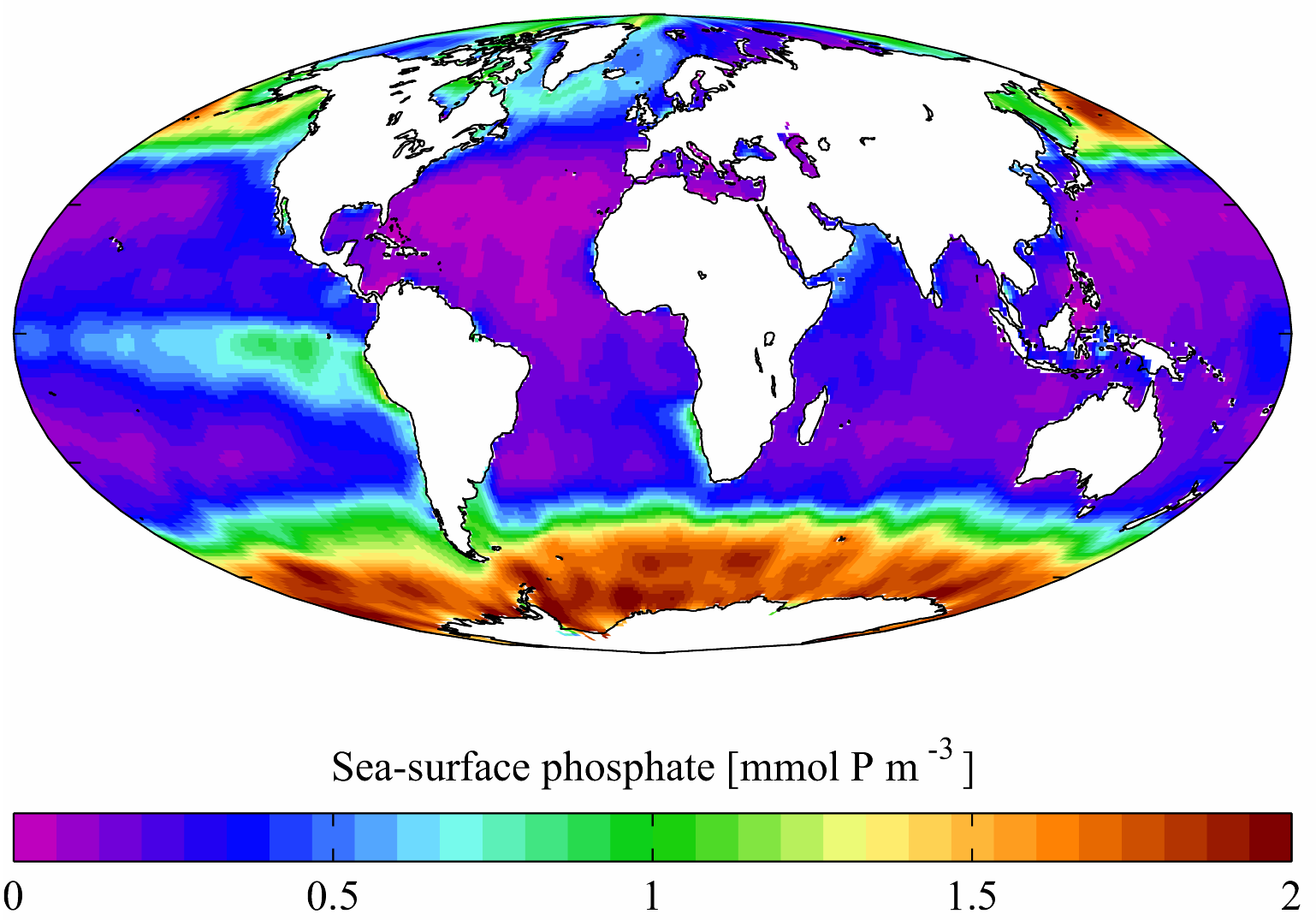
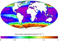 Moyenne annuelle en surface de phosphate (WOA 2001)
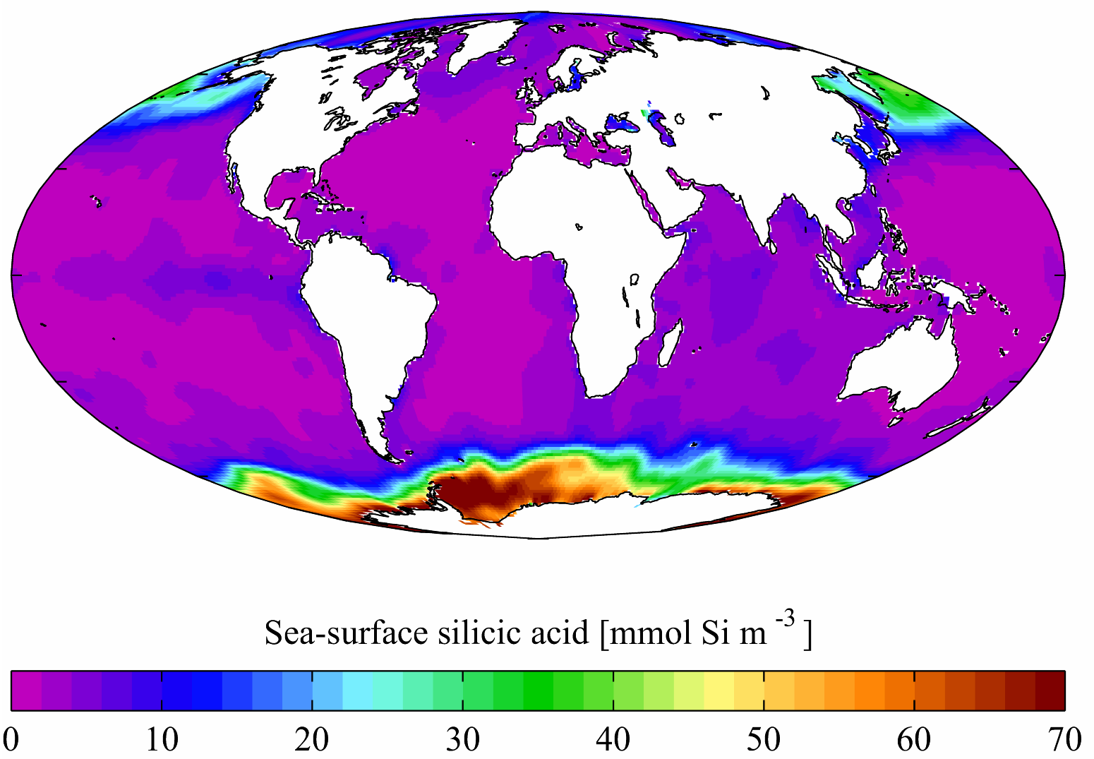
 Moyenne annuelle en surface d'acide silicique (WOA 2001)
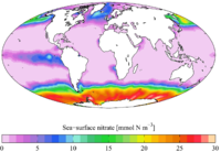 Moyenne annuelle en surface de nitrate (WOA 2005)
Notes et références
- World Ocean Atlas 1994 series, National Oceanographic Data Center, 2008-08-29. Consulté le 2008-10-22
- Levitus, S. (1982) Climatological Atlas of the World Ocean, NOAA Professional Paper No. 13, pp. 191
- World Ocean Atlas 1998 series, National Oceanographic Data Center, 2008-08-29. Consulté le 2008-10-22
- World Ocean Atlas 2001, National Oceanographic Data Center, 2007-10-04. Consulté le 2008-10-22
- World Ocean Atlas 2005, National Oceanographic Data Center, 2007-09-12. Consulté le 2008-10-22
- www.coriolis.eu.org/Science/Data-and-Products
Voir aussi
Articles connexes
- Océanographie
- Océan mondial
- évaluation environnementale
- Évaluation des écosystèmes pour le millénaire
- Observatoire de la biodiversité
- Météorologie
- Courantologie
- Grenelle de la mer (France)
- Aires marines protégées
- Zones mortes
- Munitions immergées
- Déchets en mer
- Tectonique
- Tsunami
- Cétacé
- Oiseaux marins
- Tortues marines
- Corridors biologiques sous-marins
- Courantologie
 Portail du monde maritime
 Portail des sciences de la Terre et de l’Univers


Wikimedia Foundation. 2010.