Waterbury Lake
- Waterbury Lake
-
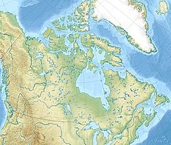
Le Waterbury Lake est un lac canadien du nord de la province de Saskatchewan.
Présentation
Il a la particularité d'être proche et au nord de la Cigar Lake Mine, mine d'uranium à haute concentration[1].
Voir aussi
Notes et références
Wikimedia Foundation.
2010.
Contenu soumis à la licence CC-BY-SA. Source : Article Waterbury Lake de Wikipédia en français (auteurs)
Regardez d'autres dictionnaires:
Waterbury Inn — (Ephraim,США) Категория отеля: 3 звездочный отель Адрес: 10321 Water Street South, Eph … Каталог отелей
Waterbury, Connecticut — Infobox Settlement official name = Waterbury, Connecticut other name = native name = nickname = The Brass City settlement type = City motto = Quid Aere Perennius (What Is More Lasting Than Brass) imagesize = image caption = flag size = image seal … Wikipedia
Waterbury, Vermont — Infobox Settlement official name = Waterbury, Vermont settlement type = Town nickname = motto = imagesize = image caption = image mapsize = 250px map caption = Waterbury, Vermont mapsize1 = map caption1 = subdivision type = Country subdivision… … Wikipedia
Hop Brook Lake — Infobox lake lake name = Hop Brook Lake image lake = caption lake = image bathymetry = caption bathymetry = location = New Haven County, Connecticut coords = coord|41|30|49|N|73|03|59|W|type:waterbody region:US CT|display=inline,title type =… … Wikipedia
Indian Lake (Ohio) — Infobox lake lake name = Indian Lake image lake = Russells point ohio indian lake arch.jpg caption lake = Bridge at Russells Point image bathymetry = caption bathymetry = location = Logan County, Ohio coords = coord|40|28|3|N|80|52|31|W|region:US … Wikipedia
Crystal Lake, Connecticut — Crystal Lake Ellington s town beach, Sandy Beach Location Ellington, Connecticut Coordinates … Wikipedia
Detroit and Lake Superior Smelter — The Detroit and Lake Superior Smelter was a copper smelter located near Hancock, Michigan on the Keweenaw Waterway. It was opened in 1860 by the Portage Lake Copper Company. The company later merged with the Waterbury and Detroit Copper Company… … Wikipedia
Coventry Lake — is a census designated place in the town of Coventry, Connecticut in Tolland County, Connecticut, United States. The population was 2,914 at the 2000 census. The CDP includes the residential areas around Wangumbaug Lake. Geography According to… … Wikipedia
Scouting in Connecticut — has gone through many organizational changes in its history. While having only eight counties, Connecticut has had 40 Boy Scout Councils since the Scouting movement began in 1910. In 1922, there were 17 separate Boy Scout Councils operating in… … Wikipedia
Connecticut Company — (blue) and other New Haven electric railway subsidiaries The Connecticut Company was the primary electric street railway company in the U.S. state of Connecticut, operating both city and rural trolleys and freight service. It was controlled by… … Wikipedia
 Canada

