Vallay
- Vallay
-
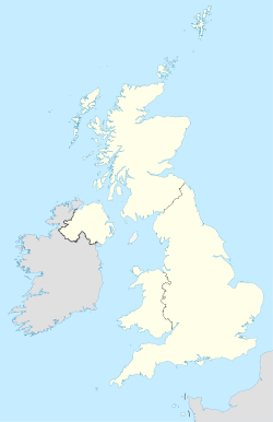
Vallay est une île du Royaume-Uni située en Écosse accessible à marée basse et inhabitée. Elle est liée à l'île de North Uist par une chaussée et, lors des marées basses, par une plage.
Autrefois, l'île comportait environ 60 personnes dont le plus célèbre habitant fut l'archéologue Erskine Beveridge. L'île est aussi connu ses oiseaux de mer et ses monuments préhistoriques.
Wikimedia Foundation.
2010.
Contenu soumis à la licence CC-BY-SA. Source : Article Vallay de Wikipédia en français (auteurs)
Regardez d'autres dictionnaires:
Vallay — VALLAY, an island, in the parish of North Uist, county of Inverness; containing 59 inhabitants. This is an island only at low water, being separated from the north shore of Uist by a shallow sound dry at the subsiding of the tide. It is a mile … A Topographical dictionary of Scotland
Vallay — (en gaélico escocés: Bhalaigh o Bhàlaigh) es una pequeña isla localizada en el grupo de las Hébridas Exteriores, en Escocia. La isla se encuentra conectada con la isla de North Uist por una carretera, así como por una larga playa durante la marea … Wikipedia Español
Vallay — Infobox Scottish island | latitude=57.40 longitude= 07.25 GridReference=NF769763 celtic name=Bhàlaigh norse name= meaning of name=hill island area=260 ha area rank=95 highest elevation=38 m Population=0 population rank= main settlement= island… … Wikipedia
Erskine Beveridge — Erskine Beveridge, LL.D., FRSE (December 27, 1851 August 10, 1920), was a Scottish textile manufacturer and antiquary. He was the owner of Erskine Beveridge Co. Ltd., which had been founded by his father in 1832 and was the largest linen… … Wikipedia
Uist, North — UIST, NORTH, an island and parish, in the county of Inverness; containing, with the islands of Balishear, Boreray, Grimsay, Heisker, Illary, Kirkibbost, Vorgay, Orinsay, Ronay, and Vallay, 4428 inhabitants, of whom 3788 are in the island of… … A Topographical dictionary of Scotland
North Uist — Location … Wikipedia
Oronsay — This is a list of islands called Oronsay (Scottish Gaelic: Orasaigh (help·info)), which provides an index for islands in Scotland with this and similar names. It is one of the more common names for Scottish islands. The names come from… … Wikipedia
Milton, Glasgow — Coordinates: 55°53′49″N 4°15′12″W / 55.897069°N 4.253317°W / 55.897069; 4.253317 … Wikipedia
Bietigheim Enz Valley Bridge — The Bietigheim Enz Valley Bridge is a well known German railway bridge over the Enz vallay at Bietigheim Bissingen and one of the landmarks of the city. It was built from 1851 1853 as part of the railway line Bietigheim Bruchsal under the… … Wikipedia
List of Sites of Special Scientific Interest in Western Isles South — The following is a list of Sites of Special Scientific Interest in the Western Isles South Area of Search; for Western Isles North see List of SSSIs in Western Isles North. For SSSIs elsewhere in Scotland, see List of SSSIs by Area of Search.*… … Wikipedia
 Royaume-Uni
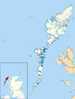
 Vallay