Vacsay
- Vacsay
-
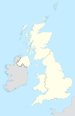
Vacsay est une île du Royaume-Uni située en Écosse.
Wikimedia Foundation.
2010.
Contenu soumis à la licence CC-BY-SA. Source : Article Vacsay de Wikipédia en français (auteurs)
Regardez d'autres dictionnaires:
Vacsay — Infobox Scottish island GridReference=NB115370 latitude=58.23 longitude= 6.91 celtic name= norse name=bakkiey or vagr øy meaning of name=peat bank or bay island area= 41 ha (101 acres) area rank=207= highest elevation=34 m (112 ft) Population=0… … Wikipedia
Список островов Шотландии — Карта Внешних и Внутренних Гебрид Этот список содержит перечисление морских и пресноводных островов Шотландии (континентальная часть которой является частью острова Великобритания). Помимо того, в список включены связанные с рас … Википедия
North Rona — Location … Wikipedia
Great Bernera — Infobox Scottish island | latitude=58.2 longitude= 6.85 GridReference=NB162344 celtic name=Bearnaraigh Mòr norse name=bjarnar øy meaning of name= Bjørn s island from Norse area= 2122 ha area rank= 34 highest elevation= 80 m Population=233… … Wikipedia
North Lochs — North Lochs, (Scottish Gaelic: Ceann a Tuath nan Loch), an area in southeast Lewis, Outer Hebrides, Scotland, is named for the many lochans (small lochs) which dot the landscape. Because of its largely undulating and rocky terrain, it is sparsely … Wikipedia
The Minch — Map of the Hebrides, showing the Minch The Little Minch, view towards Loch na Madadh … Wikipedia
Dun Carloway — Coordinates: 58°16′10.35″N 6°47′38.47″W / 58.2695417°N 6.7940194°W / 58.2695417; 6.7940194 … Wikipedia
Carloway — Coordinates: 58°16′N 6°46′W / 58.27°N 6.77°W / 58.27; 6.77 … Wikipedia
Melbost — Scottish Gaelic: Mealabost Language Scottish Gaelic English Lieutenancy area Western Isles … Wikipedia
Church of St Clement, Rodel — Saint Clement s church photographed from the pathway leading up to the main entrance St Clement s Church (Scottish Gaelic: Tùr Chliamhainn, meaning Clement s Tower) is a fifteenth century church in Rodel, Harris, Scotland, built for the Chiefs of … Wikipedia
 Royaume-Uni
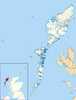
 Vacsay