Tarryall
- Tarryall
-
39° 07′ 19″ N 105° 28′ 32″ W / 39.121944, -105.475556
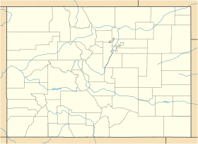
Tarryall est une localité américaine située dans le comté de Park, dans l’État du Colorado, à une altitude de 2 656 m.
Histoire
Cette section est vide, insuffisamment détaillée ou incomplète.
Votre aide est la bienvenue !
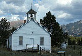
La ville a été fondée en 1896 sous le nom de Puma City suite à la découverte de minerais exploitables dans ses environs qui entraîna un boom de la population avec environ mille résidents à cette période. Un bureau de poste ouvrit rapidement mais les ressources minières décevantes entrainèrent le déclin de population permanentes. Dans les années 1900, Puma City devint Tarryall, en prenant le nom du bureau de poste.
Source
Wikimedia Foundation.
2010.
Contenu soumis à la licence CC-BY-SA. Source : Article Tarryall de Wikipédia en français (auteurs)
Regardez d'autres dictionnaires:
Tarryall Creek — is a tributary of the South Platte River, approximately 25 miles (40 km) long, in Park County in central Colorado in the United States. It drains a rural portion of north and central South Park, an intermontane grassland in the Rocky Mountains… … Wikipedia
Tarryall, Colorado (ghost town) — This article is about the ghost town of Tarryall. For the current town of Tarryall, see Tarryall, Colorado. Tarryall is a ghost town in northwest Park County, Colorado, United States. The town was located on upper Tarryall Creek northwest of Como … Wikipedia
Tarryall, Colorado — Infobox Settlement official name = Tarryall, Colorado other name = native name = nickname = settlement type = Town motto = imagesize = image caption = flag size = image seal size = image shield = shield size = image blank emblem = blank emblem… … Wikipedia
National Register of Historic Places listings in Park County, Colorado — Location of Park County in Colorado This is a list of the National Register of Historic Places listings in Park County, Colorado. This is intended to be a complete list of the properties and districts on the National Register of Historic Places… … Wikipedia
Mineralogy of the Pikes Peak Region — Pikes Peak seen from the Garden of the Gods. The Pikes Peak region is renowned for its rare mineral specimens. It is a favorite collecting area for rock hounds and serious collectors alike. Scientists from around the world come to Colorado to… … Wikipedia
Liste des villes fantômes du Colorado — Cette liste est incomplète ou mal ordonnée. Votre aide est la bienvenue ! Cet article recense les villes fantômes du Colorado, aux États Unis. Les villes fantômes du Colorado sont principalement de deux sortes : les villes minières… … Wikipédia en Français
Gold mining in Colorado — Gold mining in Colorado, a state of the United States, has been an industry since 1858, and played a key role in the establishment of the state of Colorado.Explorer Zebulon Pike heard a report of gold in South Park, present day Park County,… … Wikipedia
List of rivers of Colorado — The headwaters of the Arkansas River near Leadville, Colorado. Main article: Geography of Colorado See also: Colorado drainage basins Lists of rivers and streams in the U.S. State of Colorado … Wikipedia
Como, Colorado — Town The Como Roundhouse … Wikipedia
List of ghost towns in Colorado — Adams Alam Arapahoe … Wikipedia
 États-Unis
 Colorado