Scotstown

Scotstown
Scotstown
Administration
Pays Drapeau du Canada Canada
Province Drapeau : Québec Québec
Région Estrie
Comté ou équivalent Le Haut-Saint-François
Statut municipal Ville
Constitution 24 juin 1892
Maire
Mandat en cours
Barbara Szots
2009-2013
Démographie
Population 634 hab. (2006)
Densité 51 hab./km2
Gentilé Scotstownois, oise
Géographie
Coordonnées
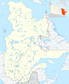
géographiques
45° 32′ 00″ N 71° 17′ 00″ W / 45.533338, -71.28333845° 32′ 00″ N 71° 17′ 00″ W / 45.533338, -71.283338
Superficie 12,40 km2
Code géographique 41080

Géolocalisation sur la carte : Québec

(Voir situation sur carte : Québec)
Scotstown

Scotstown est une ville du Québec, située dans la municipalité régionale de comté du Haut-Saint-François, dans la région administrative de l'Estrie.

Cette petite ville, fondée en 1872-1874 par des Écossais, se niche au pied du mont Mégantic et est traversée par la rivière au Saumon. Elle possède une longue histoire dont témoignent l’architecture des maisons et les quatre églises. Convertie en salle de spectacle, la petite église St-Alban offre bon nombre de concerts. Au Parc Walter-Mckenzie on remarque une immense cheminée, vestige d'un passé industriel, ainsi qu'un chute. Aujourd'hui Scotstown est un petit village paisible.

La rivière au Saumon forme au centre du village un lac appelé Étang Mill. Le chemin de fer est aussi présent dans l'histoire de Scotstown.

L'église catholique s'appelle Saint-Paul des apôtres de Scotstown.

Les industries présentes sont les Bois Beauchesne, Shermag (fermé), Aux Mille et une Saisons et Léo Desilets Maître Herboriste.


Sommaire

Municipalités limitrophes

Rose des vents Lingwick Rose des vents
N
O    Scotstown    E
S
La Patrie Hampden

Voir aussi

Sur les autres projets Wikimedia :

Articles connexes

Liens externes


Wikimedia Foundation. 2010.

Contenu soumis à la licence CC-BY-SA. Source : Article Scotstown de Wikipédia en français (auteurs)

Игры ⚽ Поможем написать курсовую

Regardez d'autres dictionnaires:

  • Scotstown — Infobox Irish Place name = Scotstown gaeilge = An Bhoth, Baile an Scotaigh crest motto = map pin coords = left: 40px; top: 40px north coord = 54.283333| west coord = 7.066667 | irish grid = area = | elevation = 72 meters, 236 feet province =… …   Wikipedia

  • Scotstown, Quebec — Scotstown is a city of 617 people in Le Haut Saint François Regional County Municipality, in Quebec, Canada …   Wikipedia

  • Scotstown Moor — in the north of Aberdeen, Scotland, was designated as a local nature reserve in 1994 because of its rich wildlife. Fact|date=January 2007 …   Wikipedia

  • Monaghan Senior Football Championship — Irish Cluiche Ceannais Muineacháin Founded 1888 Title holders Latton (4th title) Most titles Castleblayney Faughs (37 titles) …   Wikipedia

  • Скотсхаус — Деревня Ирландии Скотсхаус англ. Scotstown, ирл. Baile an Scotaigh Страна …   Википедия

  • Sheskin — Infobox Irish Place name = Sheskin gaeilge = Seiscenn crest motto = map pin coords = left: 40px; top: 40px north coord = 54.291667| west coord = 7.116667 | irish grid = area = elevation = 306 Meters, 1003 feet population = 83 census yr = 2006… …   Wikipedia

  • Renfrew —    RENFREW, a parish, burgh, and market town, in the Upper ward of the county of Renfrew, of which it is the capital; containing 3079 inhabitants, of whom 2027 are in the burgh, 3 miles (N. E. by N.) from Paisley, and 48 (W. by S.) from Edinburgh …   A Topographical dictionary of Scotland

  • Chalet ô Coq d' Ort — (Scotstown,Канада) Категория отеля: 4 звездочный отель Адрес: 13 chemin North …   Каталог отелей

  • County Monaghan — Coordinates: 54°14′37″N 7°02′22″W / 54.243563°N 7.039490°W / 54.243563; 7.039490 …   Wikipedia

  • Compton (electoral district) — Compton (also known as Mégantic Compton Stanstead) was a federal electoral district in Quebec, Canada, that was represented in the Canadian House of Commons from 1867 to 1949, and again from 1968 to 1997. Contents 1 History 2 Members of… …   Wikipedia

Share the article and excerpts

Direct link
Do a right-click on the link above
and select “Copy Link”