Ashland (Kentucky)
- Ashland (Kentucky)
-

Pour les articles homonymes, voir
Ashland.
38° 27′ 50″ N 82° 38′ 30″ W / 38.463889, -82.641667
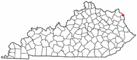
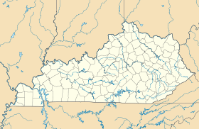
Ashland est une ville du comté de Boyd, dans le nord-est de l'État du Kentucky, aux États-Unis.
Elle est située le long de la rivière de l'Ohio. Selon le recencemment de 2000 sa population était de 21 981. Ashland est l'un des plus grands centres économiques et médicaux du nord-est du Kentucky.
Résidents célèbres
Liens externes
Wikimedia Foundation.
2010.
Contenu soumis à la licence CC-BY-SA. Source : Article Ashland (Kentucky) de Wikipédia en français (auteurs)
Regardez d'autres dictionnaires:
Ashland (Kentucky) — Ashland Ashland Lage in Kentucky … Deutsch Wikipedia
Ashland, Kentucky — Infobox Settlement official name = Ashland settlement type = City motto = A proud past. A bright future. imagesize = image caption = Downtown Ashland, Kentucky image image shield = mapsize = 250px map caption = Location of Ashland, Kentucky… … Wikipedia
Ashland, Kentucky (Amtrak station) — Infobox Station style=Amtrak name=Ashland image size= image caption= address=99 15th Street Ashland, KY 41101 line=rail color box|system=Amtrak|line=Cardinal other= platform= parking= bicycle= passengers=2,829 pass year=2007 pass percent= 1.7… … Wikipedia
History of Ashland, Kentucky — Ashland, Kentucky s recorded history begins with the migration of the Scots Irish Poage family from the Shenandoah Valley via the famed Cumberland Gap in 1786. The family settled upon a homestead along the Ohio River by the name of Poage s… … Wikipedia
Mayor of Ashland, Kentucky — Mayor of The City of Ashland, Kentucky Incumbent Tom Kelley Term length 4 years … Wikipedia
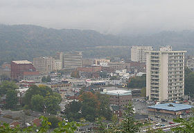
Cityscape of Ashland, Kentucky — Downtown Ashland Ashland, Kentucky s central business district extends from 12th Street to 18th Street, and from Carter Avenue to Greenup Avenue. It includes many notable buildings, such as the Paramount Arts Center, the Henry Clay Hotel and the… … Wikipedia
The Independent (Ashland, Kentucky) — Infobox Newspaper name = The Independent caption = type = Daily newspaper format = Broadsheet foundation = December 17, 1896 ceased publication = price = USD .50 daily, 1.50 Sunday owners = Community Newspaper Holdings Inc. publisher = Eddie… … Wikipedia
Roads of Ashland, Kentucky — Two U.S. highways and numerous state highways serve the city of Ashland, Kentucky directly, while an interstate and a U.S. highway serve the city indirectly. Interstates * Interstate 64 does not serve Ashland directly, however, it is listed as a… … Wikipedia
Ashland — was the name of nineteenth century statesman Henry Clay s estate in Kentucky. Because of Clay s renown in the U.S. and in other parts of the world, the name thereafter was adopted upon the establishment of many places.Ashland may refer… … Wikipedia
Ashland Bus System — Headquarters 99 15th Street Locale Ashland, KY Service type bus service Web site … Wikipedia
 États-Unis
 Kentucky