Rhinebeck (New York)

Rhinebeck (New York)

41°55′39″N 73°54′31″O / 41.9275, -73.90861

Rhinebeck
Administration
Pays Drapeau des États-Unis États-Unis
État Drapeau de l'État de New York New York
Comté Dutchess
Maire Steven Block
Site web Consulter
Historique
Fondation 1686
Démographie
Population (2000) 7 762 hab.
Densité 843,7 hab./km2
Géographie
Coordonnées 41° 55′ 39″ Nord
       73° 54′ 32″ Ouest
/ 41.927508, -73.908844
Superficie 9,2 km2
Fuseau horaire EST (UTC-5)
Voir la carte physique
Rhinebeck (New York)
Voir la carte administrative
Rhinebeck (New York)

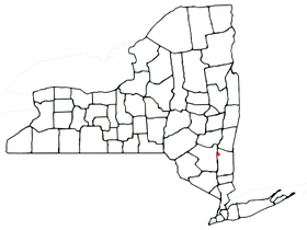
Rhinebeck est une localité du Comté de Dutchess dans l'État de New York aux États-Unis, elle comptait 7 762 habitants en 2000.

Rhinebeck est dans le nord-ouest du comté de Dutchess. Rhinebeck Village est le nom d'un village dans cette ville.

Sommaire

Géographie

La limite ouest de la ville est l'Hudson River.

Histoire

Rhinebeck est une très ancienne localité à l'échelle américaine. En 1686 des terres sont achetées aux indigènes afin d'y édifier une ville qui a l'origine se nomme "Kipsbergen". On rapporte l'arrivée des premiers habitants européens vers 1700. La ville de Rhinebeck est établie officiellement en 1788. En 1812, la ville cède une partie de son territoire pour former la nouvelle localité de Red Hook.

Nombre d'"aristocrates de l'Hudson Valley" avaient leur "manoir" dans la cité.

En 1900 sa population était de 3 472 habitants.

Personnalité

Liens externes


Wikimedia Foundation. 2010.

Contenu soumis à la licence CC-BY-SA. Source : Article Rhinebeck (New York) de Wikipédia en français (auteurs)

Игры ⚽ Поможем сделать НИР

Regardez d'autres dictionnaires:

  • National Register of Historic Places listings in Rhinebeck, New York — List of the National Register of Historic Places listings in Rhinebeck, New York Map of all coordinates from Google Map of all coordinates from Bing …   Wikipedia

  • Church of the Good Shepherd (Rhinebeck, New York) — The Church of the Good Shepherd General information Town or city Rhinebeck, New York Country United States of America Design and construction Client Roman Catholic Archdiocese of New York …   Wikipedia

  • Rock Ledge (Rhinebeck, New York) — Infobox nrhp | name =Rock Ledge nrhp type = hd caption = nearest city= Rhinebeck, New York lat degrees = 41 lat minutes = 53 lat seconds = 41 lat direction = N long degrees = 73 long minutes = 53 long seconds = 43 long direction = W locmapin =… …   Wikipedia

  • U.S. Post Office (Rhinebeck, New York) — Infobox nrhp name = U.S. Post Office nrhp type = cp caption = The post office in 2007 location = Rhinebeck, NY nearest city = Kingston, NY lat degrees = 41 lat minutes = 55 lat seconds = 35 lat direction = N long degrees = 73 long minutes = 54… …   Wikipedia

  • New York State Sheep and Wool Festival — Keyed fiddle at the 2006 festival Begins Third weekend in October Ends Sunday Frequency A …   Wikipedia

  • New York locations by per capita income — New York is the sixth richest state in the United States of America, with a per capita income of $40,272.29 (2004). [1] New York counties ranked by per capita income There are sixty two counties located in New York, six of which are in the 100… …   Wikipedia

  • New York State Route 308 — NYS Route 308 …   Wikipedia

  • Rhinebeck (town), New York — Infobox Settlement official name = Rhinebeck, New York settlement type = Town nickname = motto = imagesize = image caption = image |pushpin pushpin label position = pushpin map caption =Location within the state of New York pushpin mapsize =… …   Wikipedia

  • Rhinebeck (village), New York — Infobox Settlement official name = Rhinebeck, New York settlement type = Village nickname = motto = imagesize = image caption = image |pushpin pushpin label position = pushpin map caption =Location within the state of New York pushpin mapsize =… …   Wikipedia

  • New York Marble Cemetery — U.S. National Register of Historic Places …   Wikipedia

Share the article and excerpts

Direct link
Do a right-click on the link above
and select “Copy Link”