Rangamati
- Rangamati
-
Rangamati (bengalî : রাঙ্গামাটি, Rāṅgāmāṭi) est la capitale du Kapas Mahal ou Jumland, 75 000 habitants, en 1991. Cette ville, située sur les rives du fleuve Borgang, est fondée par le roi Chakma, Harish Chandra Rai en 1874, en quittant un des anciens palais d'hiver, Raja Nogor (Raja Nagar) à Rangunia. De nos jours, l'ancien Rangamati et le palais royal sont sous les eaux du lac artificiel de Kaptaï. Et la nouvelle Rangamati est désormais au « sommet des montagnes », au milieu de paysage tropical et luxuriant. Elle abrite un des centres bouddhistes les plus importants de l'Asie : Raj Bono Vihar. Tout près de ce kyong (temple bouddhiste), on trouve le palais royal actuel du roi des Chakma : Devasish Roy.
Wikimedia Foundation.
2010.
Contenu soumis à la licence CC-BY-SA. Source : Article Rangamati de Wikipédia en français (auteurs)
Regardez d'autres dictionnaires:
Rangamati — is the principal city of Rangamati District in the Chittagong Hill Tracts of Bangladesh. The town is located at 22°37 60N 92°12 0E and has an altitude of 14 metres (49 feet). [ [http://www.fallingrain.com/world/BG/0/Rangamati.html Location of… … Wikipedia
Rangamati — রাঙ্গামাটি Rangamati … Deutsch Wikipedia
Rangamati (Distrikt) — Rangamati (Bengalisch: রাঙ্গামাটি জেলা, Rāṅgāmāṭi jelā) ist ein Distrikt in Bangladesch. Er liegt innerhalb der südöstlichen Verwaltungseinheit, der Division Chittagong. Hauptort ist die Stadt Rangamati. Der 6116,13 km² große Verwaltungsdistrikt… … Deutsch Wikipedia
Rangamati District — Infobox of BD districts native name = Rangamati skyline = Rangamati1.jpg skyline size = skyline caption = Rangamati skyline from Tabalchhori BDR post. locator position = left latd = 22.66 longd = 92.19 division name = Chittagong Division… … Wikipedia
Rangamati Sadar Upazila — Infobox of upazilas native name = Rangamati Sadar locator position = right latd = 22.6500 longd = 92.1833 division name = Chittagong Division district = Rangamati District population as of = 1991 population total = 76732 population density = 140… … Wikipedia
Rangamati Government High School — Infobox School name = Rangamati Govt. High School established = 1890 type = Government High School vice chancellor = Teacher = president = students = professors = city = Rangamati state = country = Bangladesh campus = Rangamati Sadar free label … Wikipedia
Rangamati (district) — 22° 23′ N 92° 07′ E / 22.38, 92.12 … Wikipédia en Français
Rangamati (2008 film) — Infobox Film name = Rangamati caption = director = Kanoj Das writer = starring = Amitabh Bhattacharjee Sreela Majumdar producer = distributor = cinematography = editing = released = September 19, 2008 country = India budget = gross = preceded by … Wikipedia
Rangamati district — Admin ASC 2 Code Orig. name Rangamati district Country and Admin Code BD.84.7873929 BD … World countries Adminstrative division ASC I-II
Rāngāmāti — ▪ Bangladesh town, southeastern Bangladesh, situated in the Chittagong Hills region near the Karnaphuli River. Connected by road and river steamer with the city of Chittagong, the town is a rice milling and cotton weaving centre, and an… … Universalium
 Bangladesh
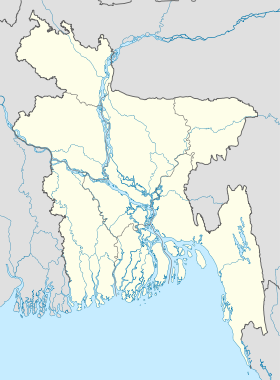
 Rangamati