Počúvadlo
- Počúvadlo
-
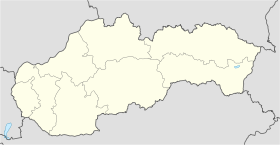
Počúvadlo (allemand : Pockhaus) , est un village de Slovaquie situé dans la région de Banská Bystrica.
Histoire
Première mention écrite du village en 1388.
Notes et références
Catégories :
- Village de Slovaquie
- Village et ville du district de Banská Štiavnica
Wikimedia Foundation.
2010.
Contenu soumis à la licence CC-BY-SA. Source : Article Počúvadlo de Wikipédia en français (auteurs)
Regardez d'autres dictionnaires:
Počúvadlo — Geobox | Settlement name = Počúvadlo other name = category = Village image caption = symbol = etymology = official name = motto = nickname = country = Slovakia country state = region = Banská Bystrica district = Banská Štiavnica commune =… … Wikipedia
Tajchy — Ciudad histórica de Banská Štiavnica y monumentos técnicos de los alrededores1 Patrimonio de la Humanidad Unesco Plaza de la Trinidad … Wikipedia Español
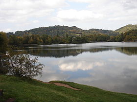
Tajchy — (singular: tajch) are artificial water reservoirs in the Štiavnica Mountains, in central Slovakia. Most of them were built in order to provide energy for the silver mines of Banská Štiavnica in the 18th century. At their height, tajchy comprised… … Wikipedia
Почувадло — словацк. Počúvadlo Координаты: Координаты … Википедия
Landschaftsschutzgebiet Štiavnické vrchy — Chránená krajinná oblasť Štiavnické vrchy Počúvadlo See, ein tajch im Landschaftsschutzgebiet … Deutsch Wikipedia
Banská Bystrica Region — Geobox | Region name = Banská Bystrica other name = category = Region image caption = image caption = symbol = symbol type = Coat of arms etymology = official name = motto = nickname = country = Slovakia country state = region = district =… … Wikipedia
Banská Štiavnica District — Infobox Slovak district subject name = Banská Štiavnica District region district slovak region = Banská Bystrica Region population = 17,092 (2001) prefix = 45 area = 292 car plate = BS image location = Okres stiavnica.png Banská Štiavnica… … Wikipedia
Dekýš — Coordinates: 48°24′N 18°46′E / 48.4°N 18.767°E / 48.4; 18.767 … Wikipedia
Močiar — is a village and municipality in Banská Štiavnica District, in the Banská Bystrica Region of Slovakia. v · Banská Štia … Wikipedia
List of municipalities and towns in Slovakia — Slovakia This is a comprehensive list of municipalities and towns in Slovakia. For lists of towns and municipalities sorted by Regions see the individual articles on Regions. For an outdated list of towns only in Slovakia see also List of towns… … Wikipedia
 Slovaquie
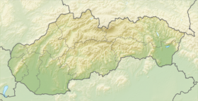
 Počúvadlo