Mottama

Mottama

Martaban

MyanmarMon.png

16°32′N 97°36′E / 16.533, 97.6

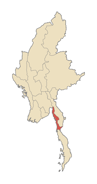
Martaban, que le régime birman actuel écrit Mottama, est une ville du district de Thaton dans l'état Môn, dans le sud de la Birmanie. Elle est située sur la rive droite de la Salween, à l'endroit où celle-ci se jette dans le golfe de Martaban (mer d'Andaman).

Martaban était le terminus de la route et de la voie ferrée de Rangoun, jusqu'à l'ouverture du pont qui la relie à Moulmein (18 avril 2005).

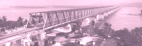
Pont Martaban-Moulmein

Histoire

La tradition veut que Martaban ait été fondée en 573 après J.C. par le premier roi de Pégou. Elle fut la capitale du royaume de Talaing.

Au XVIe siècle, c'était un comptoir commercial fréquenté par les Européens. On y fabriquait un type de jarre appelé "jarre de Pégou".

Les Anglais ont conquis la ville au cours des deux premières guerres anglo-birmanes, d'abord en 1824 puis en 1852.

  • Portail de la Birmanie Portail de la Birmanie
Ce document provient de « Martaban ».

Wikimedia Foundation. 2010.

Contenu soumis à la licence CC-BY-SA. Source : Article Mottama de Wikipédia en français (auteurs)

Игры ⚽ Нужно сделать НИР?

Regardez d'autres dictionnaires:

  • Mottama — မုတ္ထမ …   Wikipedia

  • Mottama —    See Martaban …   Historical Dictionary of Burma (Myanmar)

  • Martaban —    (Mottama)    Located at the mouth of the Salween (Thanlwin) River across from Moulmein (Mawlamyine) in Mon State, fronting the Gulf of Martaban, Martaban is the site of a port and Mon kingdom, established by Wareru in the late thirteenth… …   Historical Dictionary of Burma (Myanmar)

  • Thanlwin Bridge (Mawlamyaing) — Infobox Bridge bridge name=Thanlwin (Mawlamyaing) Bridge caption= official name= Thanlwin Bridge, (Mawlamyaing) also known as= carries= 2 lanes (SB and NB), 1 rail track (14 ft), 2 sidewalks(6 ft each) crosses= Salween River via Shampoo Island… …   Wikipedia

  • Thanlwin Bridge (Mawlamyine) — Thanlwin (Mawlamyaing) Bridge သံလွင်တံတား (မော်လမြိုင်) Official name Thanlwin Bridge, (Mawlamyaing) …   Wikipedia

  • Mon State — မွန်ပြည်နယ်   State   Myanma transcription(s)    Burmese …   Wikipedia

  • Naungdawgyi — နောင်တော်ကြီး King of Burma Prince of Dabayin Reign 11 May 1760 – 28 November 1763 ( 100000000000000030000003 years, 10000000000000201000000201 days) …   Wikipedia

  • Martaban — Mottama Le pont Martaban Moulmein sur la Salouen Administration …   Wikipédia en Français

  • Myanmar Railways — မြန်မာ့ မီးရထား Rail network in 2008 Locale Myanmar Dates …   Wikipedia

  • Mon State —    One of Burma s 14 states and divisions, with an area of 12,297 square kilometers (4,748 square miles) and a population estimated at 2.5 million in 2000 (1983 census figure: 1,680,157). Ethnically, the population is largely Mon and Burman… …   Historical Dictionary of Burma (Myanmar)

Share the article and excerpts

Direct link
Do a right-click on the link above
and select “Copy Link”