Lopikerkapel
Contenu soumis à la licence CC-BY-SA. Source : Article Lopikerkapel de Wikipédia en français (auteurs)
Regardez d'autres dictionnaires:
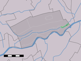
Lopikerkapel — Dutch town locator maps mun town caption = The town centre (darkgreen) and the statistical district (lightgreen) of Lopikerkapel in the municipality of Lopik.Lopikerkapel (coord|51.60|N|5.3|E|type:city(145)) is a town in the Dutch province of… … Wikipedia
Lopik — Héraldique … Wikipédia en Français
Uitweg — 51°58′57″N 5°0′52″E / 51.9825, 5.01444 … Wikipédia en Français
Lopik — Infobox Settlement official name = Lopik mapsize = 280px subdivision type = Country subdivision name = Netherlands subdivision type1 = Province subdivision name1 = Utrecht leader name = M.A.A. Schakel leader party = CDA area footnotes = (2006)… … Wikipedia
List of places in the Netherlands — This is an alphabetical list of places (cities, towns, villages) in the Netherlands. Lists per province can be found at:* List of towns in Groningen * List of towns in Friesland * List of towns in Drente * List of towns in Overijssel * List of… … Wikipedia
Uitweg — Dutch town locator maps mun town caption = Uitweg in the municipality of Lopik.Uitweg (coord|51|59|N|5|1|E|type:city(121)) is a town in the Dutch province of Utrecht. It is a part of the municipality of Lopik, and lies about 5 km southwest of… … Wikipedia
Lopik — Gemeinde Lopik Flagge Wappen Provinz Utrecht Sitz der Gemeinde Lopik … Deutsch Wikipedia
Benschop — 52°0′26″N 4°58′46″E / 52.00722, 4.97944 … Wikipédia en Français
Cabauw — 51°57′52″N 4°53′54″E / 51.96444, 4.89833 … Wikipédia en Français
Enge IJssel — Caractéristiques Longueur 4,25 km Bassin ? Bassin collecteur Rhin … Wikipédia en Français
 Pays-Bas