Longay
- Longay
-

Ne doit pas être confondu avec
Longa.
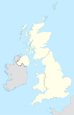
Longay est une île du Royaume-Uni située en Écosse.
Catégories :
- Île des Hébrides intérieures
- Île du Minch
Wikimedia Foundation.
2010.
Contenu soumis à la licence CC-BY-SA. Source : Article Longay de Wikipédia en français (auteurs)
Regardez d'autres dictionnaires:
Longay — es una pequeña isla deshabitada, localizada en el grupo de islas de las Hébridas Interiores, en Escocia. La isla se encuentra frente a la costa de Skye, al norte de Pabay y al este de Scalpay.[1] [2] En 1971 un barco colisionó con Longay,… … Wikipedia Español
Longay — Vorlage:Infobox Insel/Wartung/Fläche fehltVorlage:Infobox Insel/Wartung/Höhe fehlt Longay Lage von Longay nordöstlich von Skye Gewässer … Deutsch Wikipedia
Longay — Infobox Scottish island GridReference=NG658310 latitude=57.31 longitude= 5.89 celtic name=Longaigh norse name=Long øy meaning of name= longship island area= 50 ha (124 acres) area rank= 192= highest elevation= 67 m (220 ft)) Population=0… … Wikipedia
Longaigh — Die Lage der Insel Longay Longay (schottisch gälisch: Longaigh), ist eine kleine, unbewohnte Insel der Inneren Hebriden. Sie liegt zwischen dem Festland und der Insel Scalpay. Zusammen mit ihrer Nachbarinsel Pabay war Longay im 16. Jahrhundert… … Deutsch Wikipedia
Pabay — Lage von Pabay nordöstlich von Skye Gewässer Inner Sound (Atlantischer Ozean) Inselgruppe … Deutsch Wikipedia
Suzuki method — The nihongo|Suzuki method|スズキ・メソード|Suzuki mesōdo|extra=also called Talent Education, mother tongue method, or Suzuki movement is an educational philosophy which strives to create high ability and beautiful character in its students through a… … Wikipedia
Canna (Insel) — Ruine des Coroghan Castle (An Coroghon) am östlichen Ende von Canna Canna (Schottisch gälisch: Canaigh) ist die westlichste der „Kleinen Inseln“, die Bestandteil der schottischen Inneren Hebriden sind. Sie ist 4,5 km lang. Die Insel gehört dem… … Deutsch Wikipedia
Diura — Jura Jura Jura, schottisch gälisch Diùra, englisch auch Isle of Jura, ist eine Insel der Inneren Hebriden in Schottland. Jura liegt nordöstlich der größeren Insel Islay … Deutsch Wikipedia
Diùra — Jura Jura Jura, schottisch gälisch Diùra, englisch auch Isle of Jura, ist eine Insel der Inneren Hebriden in Schottland. Jura liegt nordöstlich der größeren Insel Islay … Deutsch Wikipedia
Eilean Muile — Die typische Landschaft Mulls im Frühjahr Mull (schottisch gälisch Eilean Muile) ist eine Insel an der Nordwestküste Schottlands, die zum Argyll Bute Council gehört. Inhaltsverzeichnis 1 Geographie … Deutsch Wikipedia
 Royaume-Uni
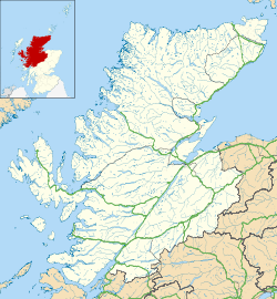
 Longay