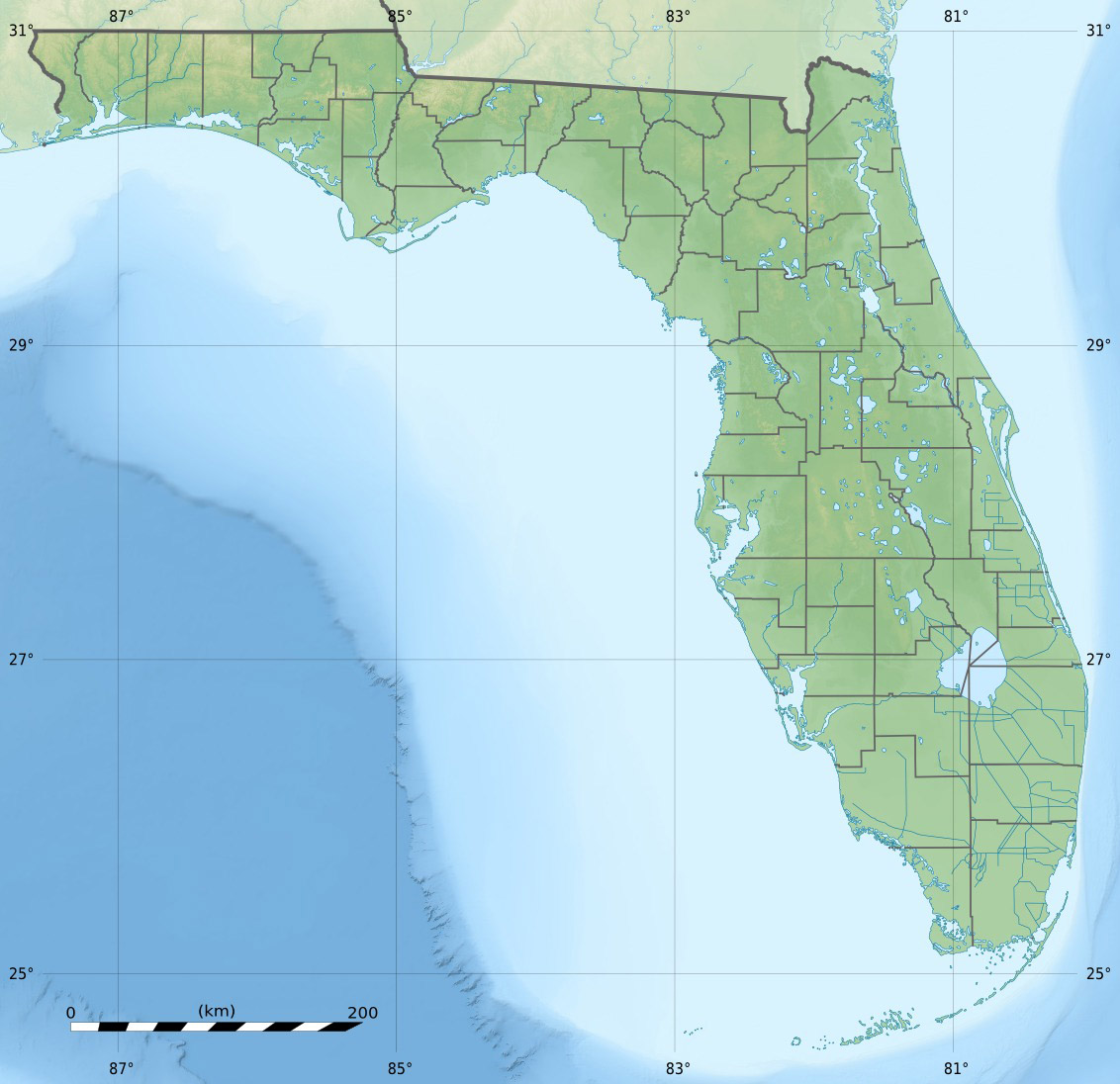
Lignumvitae Key
Contenu soumis à la licence CC-BY-SA. Source : Article Lignumvitae Key de Wikipédia en français (auteurs)
Regardez d'autres dictionnaires:
Lignumvitae Key — is an island in the upper Florida Keys.It is located due north of, and less than one mile from the easternmost tip of Lower Matecumbe Key. The island has the Keys highest point above sea level of convert|19|ft|m, [ [http://www.peakbagger.com/peak … Wikipedia
Lignumvitae Key State Botanical Park — Infobox protected area | name = Lignumvitae Key Archeological and Historical District iucn category = V caption = locator x = 238 locator y = 173 location = Monroe County, Florida, USA nearest city = Islamorada, Florida lat degrees = lat minutes … Wikipedia
Key deer — A male Key Deer on No Name Key in the Florida Keys Conservation status … Wikipedia
Key Largo — Coordinates: 25°05′11″N 80°26′50″W / 25.0865°N 80.4473°W / 25.0865; 80.4473 … Wikipedia
National Key Deer Refuge — Coordinates: 24°44′00″N 81°24′00″W / 24.7333333°N 81.4°W / 24.7333333; 81.4 The National Key Deer Refuge is a 8,542 acre (34 … Wikipedia
Dagny Johnson Key Largo Hammock Botanical State Park — IUCN Category V (Protected Landscape/Seascape) … Wikipedia
Cudjoe Key, Florida — CDP Location in … Wikipedia
Meig's Key — is a small island north of the upper Florida Keys in Biscayne National Park. It is in Miami Dade County, Florida. It is located in southern Biscayne Bay, just north of Old Rhodes Key and Totten Key, just southeast off the southern tip of Elliott… … Wikipedia
Conch Key, Florida — Unincorporated area U.S. Census Bureau map of Duck Key CDP showing boundaries which include Conch Key … Wikipedia
Duck Key — This article is about the island. For the census designated place, see Duck Key, Florida. Duck Key is an island in Monroe County, Florida, United States, in the middle Florida Keys.It is part of the Duck Key, Florida census designated place. The… … Wikipedia
 États-Unis
 Lignumvitae Key