Kľušov
- Kľušov
-
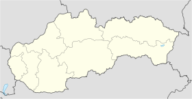
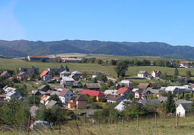
Kľušov (allemand : Kluschdorf), est un village de Slovaquie situé dans la région de Prešov.
Histoire
Première mention écrite du village en 1330.
Notes et références
Catégories :
- Village de Slovaquie
- Village et ville du district de Bardejov
Wikimedia Foundation.
2010.
Contenu soumis à la licence CC-BY-SA. Source : Article Kľušov de Wikipédia en français (auteurs)
Regardez d'autres dictionnaires:
Kľušov — is a village and small municipality in Bardejov District in the Prešov Region of north east Slovakia.HistoryIn historical records the village was first mentioned in 1330.GeographyThe municipality lies at an altitude of 317 metres and covers an… … Wikipedia
Kluzov — Kluzov … Deutsch Wikipedia
Hertník — Geobox |settlement name = Hertník category = Village etymology = official name = motto = nickname = image caption = View of Hertník from the nearby Štembroch hill. symbol = country = Slovakia country state = region = Prešov district = Bardejov… … Wikipedia
Hervartov — Wappen Karte … Deutsch Wikipedia
Prešov Region — Geobox | Region name = Prešov category = Region image caption = image caption = symbol = symbol type = etymology = official name = motto = nickname = country = Slovakia country state = region = district = commune = municipality = border = part… … Wikipedia
Bardejov District — District Country Slovakia Region … Wikipedia
List of municipalities and towns in Slovakia — Slovakia This is a comprehensive list of municipalities and towns in Slovakia. For lists of towns and municipalities sorted by Regions see the individual articles on Regions. For an outdated list of towns only in Slovakia see also List of towns… … Wikipedia
Cigeľka — Location of Bardejov District in the Prešov region Cigeľka is a village and municipality in Bardejov District in the Prešov Region of north east Slovakia with Ruthenian and Roma inhabitants. It lies in the valley of Oľchovec below the Busov hill… … Wikipedia
Dubinné — Location of Bardejov District in the Nitra region Dubinné is a village and municipality in Bardejov District in the Prešov Region of north east Slovakia. History In historical records the village was first mentioned in 1327 … Wikipedia
Chmeľová — Location of Bardejov District in the Prešov region Chmeľová is a village and small municipality in Bardejov District in the Prešov Region of north east Slovakia, formerly known as Komloša. History In historical records the … Wikipedia
 Slovaquie
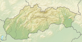
 Kľušov