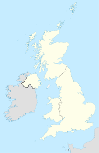
Kidlington
Contenu soumis à la licence CC-BY-SA. Source : Article Kidlington de Wikipédia en français (auteurs)
Regardez d'autres dictionnaires:
Kidlington — … Wikipedia Español
Kidlington — infobox UK place country = England latitude= 51.8233 longitude= 1.2914 official name= Kidlington shire district= Cherwell shire county = Oxfordshire region= South East England constituency westminster= post town= KIDLINGTON|postcode district =… … Wikipedia
Kidlington F.C. — Football club infobox clubname = Kidlington fullname = Kidlington Football Club nickname = The Greens founded = 1909 ground = Yarnton Road, Kidlington capacity = chairman = Geoff Talboys manager = Paul Lee league = Hellenic Football League… … Wikipedia
Kidlington — Original name in latin Kidlington Name in other language Kidlington State code GB Continent/City Europe/London longitude 51.82166 latitude 1.2886 altitude 64 Population 15278 Date 2011 03 03 … Cities with a population over 1000 database
London Oxford Airport — Oxford Airport Oxford/Kidlington Airport IATA: OXF – ICAO: EGTK Summary Airport type Private … Wikipedia
Oxford Airport — Infobox Airport name = Oxford Airport nativename = nativename a = nativename r = Oxford/Kidlington Airport image width = caption = IATA = OXF ICAO = EGTK type = Private owner = Oxford Aviation Services Ltd. operator = Oxford Aviation Services Ltd … Wikipedia
Oxfordshire — Coat of arms of Oxfordshire Flag of Oxfordshire Motto of … Wikipedia
Oxford West and Abingdon (UK Parliament constituency) — Oxford West and Abingdon County constituency for the House of Commons Boundary of Oxford West and Abingdon in … Wikipedia
Cherwell local elections — One third of Cherwell District Council in Oxfordshire, England is elected each year, followed by one year without election. Since the last boundary changes in 2002, 50 councillors have been elected from 28 wards.[1] Contents 1 Political control 2 … Wikipedia
2009–10 Oxford United F.C. season — Oxford United 2009 10 season Chairman Kelvin Thomas Manager … Wikipedia

 Angleterre