Kerang

Kerang

35°43′53″S 143°55′13″E / -35.73139, 143.92028

Kerang
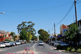
La grand rue de Kerang
Administration
Pays Drapeau d'Australie Australie
État Victoria
Code postal VIC 3579
Maire Keith den Houting
Comté de Gannawarra
Géographie
Coordonnées 35° 43′ 53″ Sud
       143° 55′ 13″ Est
/ -35.73139, 143.92028
Altitude 78 m
Démographie
Population 3 780 hab. (2006)
Localisation

  Géolocalisation sur la carte : Victoria

Voir sur la carte : Victoria
City locator 14.svg
Kerang

  Géolocalisation sur la carte : Australie

Voir sur la carte : Australie
City locator 14.svg
Kerang

Kerang (3 780 habitants) est une ville du nord de l'État de Victoria à 279 km au nord-ouest de Melbourne sur la rivière Loddon.

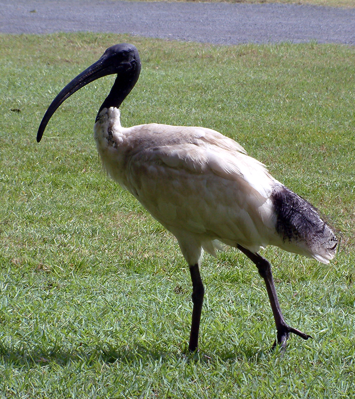
Kerang est entourée de marais et de lacs et la région est considérée comme la plus grande nursery au monde d'ibis avec plus de 200 000 oiseaux venant se reproduire chaque année dans la région sans compter les autres espèces d'oiseaux migrateurs.

La ville est le centre d'une région agricole irriguée et vivant de l'horticulture, de la culture de céréales et de luzerne, de l'élevage de vaches laitières.

Les aborigènes Wemba-Wemba ont été les premiers habitants de la région. Thomas Mitchell fut le premier Européen à explorer la zone en 1836. Les premiers colons s'installèrent dans la région en 1845 et en 1848, Richard Beyes ouvrit le premier café près d'un gué traversant la Loddon puis en 1857 Woodford Patchell construisit un pont sur la rivière un peu en amont à l'endroit qui allait devenir la ville de Kerang et aménagea à proximité un magasin, un hôtel. Il fut aussi le premier fermier à utiliser l'irrigation et essaya de cultiver ainsi de l'orge, de l'avoine, du maïs, du millet, du tabac, des betteraves, du coton, de la canne à sucre.

La construction d'une voie de chemin de fer venant de Bendigo en 1884 et la mise en service d'une ligne de tramway jusqu'à Koondrook en 1888 ajoutées à l'irrigation des champs favorisèrent l'expansion de la ville.

Un ibis australien analogue à ceux de Kerang

Accident de chemin de fer

Le 5 juin 2007, un semiremorque a percurté un train reliant Swan Hill à Melbourne à 6 km au nord de Kerang au passage à niveau non gardé avec la nationale "Murray Valley Highway". L'accident a fait 11 morts et 22 blessés[1].

Référence

  1. Level crossing crash: 8 dead, dozens injured. ABC. 5 June 2007. Retrieved on 5 June 2007.

Liens externes

Sur les autres projets Wikimedia :


Wikimedia Foundation. 2010.

Contenu soumis à la licence CC-BY-SA. Source : Article Kerang de Wikipédia en français (auteurs)

Игры ⚽ Нужно решить контрольную?

Regardez d'autres dictionnaires:

  • Kerang — Hauptstraße Kerangs Staat …   Deutsch Wikipedia

  • Kerang — ▪ Victoria, Australia       town, northern Victoria, Australia, on the Loddon River. Its name derives from an Aboriginal term with several possible meanings, including “cockatoo,” “parasite,” “moon,” “edible root vegetable,” or “leaves of a… …   Universalium

  • Kerang, Victoria — Infobox Australian Place | type = town name = Kerang state = vic caption = Victoria Street in central Kerang lga = Shire of Gannawarra postcode = 3579 est = pop = 3780 (2006)Census 2006 AUS | id = SSC25859 | name = Kerang (State Suburb) |… …   Wikipedia

  • Kerang rail accident — infobox AU rail accident title = Kerang rail accident date = 5 June 2007 time = 1:40pm location = Kerang, Victoria location dist = 257.2 location dir = NNW location city = Melbourne line = Swan Hill railway line operator = V/Line type = Level… …   Wikipedia

  • Kerang railway station, Victoria — VlineRailwayStation1 NAME=Kerang IMAGELINK=Kerang2.jpg CAPTION=Platform looking towards Swan Hill CODE=KER DISTANCE=291.88 km LINES=Swan Hill PLATFORMS=1 TRACKS=1 STATUS=Staffed Station FACILITIES= [http://www.viclink.com.au/stop/view/20318 Link] …   Wikipedia

  • Kerang Airport — Infobox Airport name = Kerang Airport nativename = nativename a = nativename r = image width = caption = IATA = KRA ICAO = YKER type = Public owner = operator = Gannawarra Shire Council city served = location = Kerang, Victoria elevation f = 254… …   Wikipedia

  • Kerang-Koondrook Tramway — The Kerang Koondrook Tramway was an Australian private railway of RailGauge|63 broad gauge, running from the state owned Victorian Railways network at Kerang to the Murray River town of Koondrook.The convert|13.94|mi|km long line was opened in… …   Wikipedia

  • Kerang — /kəˈræŋ/ (say kuh rang) noun a town and shire in north western Victoria, on the Loddon River …  

  • Shire of Kerang — Infobox Australian Place | type = lga name = Shire of Kerang state = vic region = area = 3254.45 est = 1862 seat = Kerang pop = 4380 (1992) [cite book|title=Victorian Year Book|author=Australian Bureau of Statistics, Victoria… …   Wikipedia

  • Borough of Kerang — Infobox Australian Place | type = lga name = Borough of Kerang state = vic region = area = 22.60 est = 1966 seat = Kerang pop = 4300 (1992) [cite book|title=Victorian Year Book|author=Australian Bureau of Statistics, Victoria… …   Wikipedia

Share the article and excerpts

Direct link
Do a right-click on the link above
and select “Copy Link”