Iwanuma
- Iwanuma
-
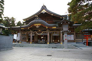
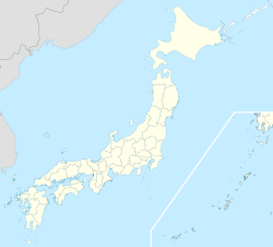
Iwanuma (岩沼市, Iwanuma-shi?) est une ville de la préfecture de Miyagi, au Japon.
La ville a été fondée le 1er novembre 1971.
La population de la ville est de 44 557 habitants pour une superficie de 60.71 km² (2010).
Liens externes
Catégories :
- Municipalité de la préfecture de Miyagi
- Ville du Japon
- Ville détruite par le séisme de 2011 de la côte Pacifique du Tōhoku
Wikimedia Foundation.
2010.
Contenu soumis à la licence CC-BY-SA. Source : Article Iwanuma de Wikipédia en français (auteurs)
Regardez d'autres dictionnaires:
Iwanuma — shi 岩沼市 Geographische Lage in Japan … Deutsch Wikipedia
Iwanuma — Original name in latin Iwanuma Name in other language Iwanuma State code JP Continent/City Asia/Tokyo longitude 38.10472 latitude 140.85944 altitude 5 Population 42411 Date 2012 01 19 … Cities with a population over 1000 database
Iwanuma, Miyagi — Japanese city Name = Iwanuma City JapaneseName = 岩沼市 Map Region = Tōhoku Prefecture = Miyagi Prefecture District = Area km2 = 60.72 PopDate = 2006 Population = 44,228 Density km2 = 728.39 Coords = coord|38|06|N|140|52|E|display=inline,title|region… … Wikipedia
Iwanuma Station — infobox japan station namerom=Iwanuma name=岩沼 imagesize= caption= pref=Miyagi city=Iwanuma ward= town= village= district= address= jaloc= postal= open=1887 close= oldname= presentname= station number= operator=JR East line=Jōban Line, Tōhoku Main … Wikipedia
Iwanuma-shi — Admin ASC 2 Code Orig. name Iwanuma shi Country and Admin Code JP.00.2112525 JP … World countries Adminstrative division ASC I-II
Jōban Line — The nihongo|Jōban Line|常磐線|Jōban sen is a rail line in Japan and is part of the East Japan Railway Company (JR East) system. It begins in Taitō ku in Tokyo and follows the Pacific coasts of Chiba, Ibaraki, and Fukushima Prefectures before the… … Wikipedia
Natori District, Miyagi — (List of provinces of Japan > Tōsandō > Rikuzen Province > Natori District) Natori District (名取郡, Natori gun?) was a district located in Rikuzen Province (formerly in the central part of Mutsu Province) → Miyagi Prefecture. History Refer … Wikipedia
Natori — shi 名取市 Geographische Lage in Japan … Deutsch Wikipedia
Tōhoku-Erdbeben 2011 — Vorlage:Infobox Erdbeben/Wartung/Sachschaden fehlt Großes Tōhoku Erdbeben … Deutsch Wikipedia
Natori, Miyagi — For other uses, see Natori (disambiguation). Natori City 名取市 City … Wikipedia