Ipojuca

Ipojuca
Ipojuca
Administration
Pays Drapeau : Brésil Brésil
Région Nord-Est
État Pernambouc Pernambouc
Maire Pedro Serafim (PDT)
Démographie
Population 69 781 hab. (IBGE 04/2007)
Densité 132 hab./km²
Gentilé ipojucano
Géographie
Coordonnées 8° 24′ 00″ S 35° 03′ 45″ W / -8.4, -35.06258° 24′ 00″ Sud
       35° 03′ 45″ Ouest
/ -8.4, -35.0625
  
Altitude 10 m
Superficie 527 km2
Informations
Date de fondation 1861
Fuseau horaire UTC-3
Indicatif téléphonique 81
Localisation de Ipojuca
Voir la carte administrative
City locator 14.svg
Voir la carte topographique
City locator 14.svg

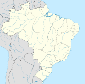
Ipojuca est une ville brésilienne du littoral de l'État du Pernambouc.

Géographie

Ipojuca se situe par une latitude de 08º 24' 00" sud et par une longitude de 35º 03' 45" ouest, à une altitude de 10 mètres.

Sa population était de 69 781 habitants au recensement de 2007[1]. La municipalité s'étend sur 527 km²[2].

Elle fait partie de la microrégion de Suape, dans la mésorégion métropolitaine de Recife.

Elle fait également partie de la région métropolitaine de Recife.

Références


Wikimedia Foundation. 2010.

Contenu soumis à la licence CC-BY-SA. Source : Article Ipojuca de Wikipédia en français (auteurs)

Игры ⚽ Нужен реферат?

Regardez d'autres dictionnaires:

  • Ipojuca — is a municipality in Pernambuco. As of 2007 the population was 70,070 and the per capita income was R$51,577. (Over $25,000 in US dollars) The settlement dates to 1560, but the official founding date is 1861 …   Wikipedia

  • Ipojuca — Original name in latin Ipojuca Name in other language Ipozhuka, Pojuca, Ипожука State code BR Continent/City America/Recife longitude 8.39889 latitude 35.06389 altitude 29 Population 53364 Date 2012 08 03 …   Cities with a population over 1000 database

  • Ipojuca — Sp Ipožukà Ap Ipojuca L u., g tė Brazilijoje (Pernambukas) …   Pasaulio vietovardžiai. Internetinė duomenų bazė

  • Ipojuca — Admin ASC 2 Code Orig. name Ipojuca Country and Admin Code BR.30.2607208 BR …   World countries Adminstrative division ASC I-II

  • Microrregión del Valle del Ipojuca — Mapa Entidad Microrregión  • País …   Wikipedia Español

  • Recife —   Municipality   The Municipality of Recife From upper left: Old centre of Recife; Recife …   Wikipedia

  • Arturo Gatti — Gatti on November 24, 2002 Statistics Real name Arturo Gatti Nickname(s) Thunder …   Wikipedia

  • Gravatá — is a city in the state of Pernambuco, Brazil, located about 75 km from the state s capital Recife (the distance by road ist 85 km). The population of Gravatá in 2004 was 70 243 inhabitants. Geography Gravatá is located to… …   Wikipedia

  • Porto de Suape — 8.3988888888889 34.962222222222 Koordinaten: 8° 24′ S, 34° 58′ W Suape …   Deutsch Wikipedia

  • Microrégion de Suape — La microrégion de Suape est l une des quatre microrégions qui subdivisent la mésorégion métropolitaine de Recife de l État du Pernambouc au Brésil. Elle comporte deux municipalités qui regroupaient 232 257 habitants après le recensement de… …   Wikipédia en Français

Share the article and excerpts

Direct link
Do a right-click on the link above
and select “Copy Link”