- Interstate 35
-
Interstate 35 
Longueur 2523 km (1568 mi) Ouverture 1956 Direction sud / nord Extrémité sud 
 US 83/I-35 BUS à Laredo, TX
Intersections  I-10 à San Antonio, TX
 I-20 à Dallas-Fort Worth, TX
 I-30 à Dallas-Fort Worth, TX
 I-40 à Oklahoma City, OK
 I-70 à Kansas City, MO
 I-80 près de Des Moines, IA
 I-90 près de Albert Lea, MN
Extrémité nord  MIN 61 à Duluth, MN
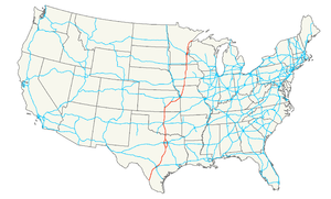
Réseau Interstate highway L'Interstate 35 (I-35), est une autoroute inter-États qui traverse le centre des États-Unis du sud au nord, du Texas au Minnesota.
Créée en 1956 (le tracé définitif date de 1982), elle mesure 1568 miles (2523 km).Villes principales
- Laredo, Texas
- San Antonio, Texas
- Austin, Texas
- Temple, Texas
- Waco, Texas
- Dallas, Texas
- Fort Worth, Texas
- Denton, Texas
- Norman, Oklahoma
- Oklahoma City, Oklahoma
- Wichita, Kansas
- Kansas City, Kansas
- Kansas City, Missouri
- Des Moines, Iowa
- Ames, Iowa
- Mason City, Iowa
- Albert Lea, Minnesota
- Owatonna, Minnesota
- St. Paul, Minnesota
- Minneapolis, Minnesota
- Duluth, Minnesota
Voir aussi
Autoroutes inter-États (principales en rose) 
4 5 8 10 12 15 16 17 19 20 22 24 25 26 27 29 30 35 37 39 40 43 44 45 49 55 57 59 64 65 66 68 69 70 71 72 73 74 75 76 (W) 76 (E) 77 78 79 80 81 82 83 84 (W) 84 (E) 85 86 (W) 86 (E) 87 88 (W) 88 (E) 89 90 91 93 94 95 96 97 99 (238) H-1 H-2 H-3 Autres A-1 A-2 A-3 A-4 PRI-1 PRI-2 PRI-3 Catégorie :- Autoroute inter-États américaine


Wikimedia Foundation. 2010.