- Alegrete (Rio Grande Do Sul)
-
Alegrete (Rio Grande do Sul)
 Pour l’article homonyme, voir Alegrete.
 Alegrete 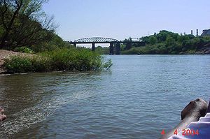
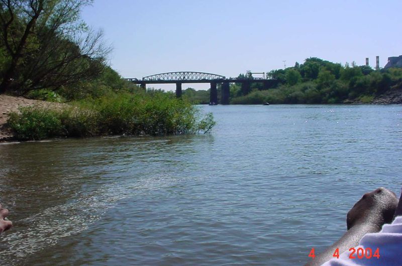
Vue du rio Ibirapuitã.
Blason d'Alegrete Administration Pays Région État  Brésil
Sud
Brésil
Sud
 Rio Grande do Sul
Maire Erasmo Guterres Silva Fondateur Date de fondation João Manuel Pinto 22 janvier 1857 Création de la municipalité {{{création}}} Site officiel de Alegrete Démographie Population 78 188 hab. (IBGE 01-04-2007) Aire urbaine hab. Densité 10,0 hab./km² Gentilé alegrense Langue(s) portugais Géographie Fuseau horaire Heure d'été UTC-3 UTC-2 Indicatif téléphonique 55 Code postal 97 543-390 Superficie 7 804 km² Altitude 102 m. Latitude
LongitudeLocalisation de Alegrete 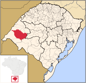
Centres d'intérêts écotourisme Alegrete est une importante et la plus grande municipalité située dans l'État du Rio Grande do Sul, au Brésil.
Elle a une superficie de 7 803,967 km² et compte 88 513 habitants (2006). Son altitude moyenne est de 102 m.
La température moyenne est de 24,8°C. La moyenne pluviométrique annuelle est de 1525 mm.
Sommaire
Histoire
Le hameau, sur le bord gauche du rio Ibirapuitã, fut fondé en 1817 et élevé à la catégorie de bourg en 1831. Il fut transformé en ville le 22 janvier 1857.
Elle fut la troisième et la dernière Capitale "Farroupilha" (Révolution Farroupilha), du 1842 au 1845, et est considérée la ville plus "gaúcha" du monde.
Chaque 20 septembre (Le Jour du Gaúcho) a lieu un orgueilleux défilé équestre avec environ 8.000 personnes, avec beaux habillements traditionnels et chevaux richement harnachés. C'est le plus grand défilé, de ce type, dans tout le monde.
La patronne de la ville est Notre-Dame de l'Immaculée Conception Apparue. Sa fête se célèbre le 8 décembre.
Personnalités nées à Alegrete
- Osvaldo Aranha - Politique, diplomate, homme d'État et président de l'ONU en 1947 ;
- Mário Quintana - Poète.
Maires
Économie
Son économie est basée principalement sur l'agriculture, avec le riz (45.000 ha), le soja et le blé. L'élevage bovin (536 536) et ovin est aussi important.
Alegrete possède un aéroport (code AITA : ALQ).
Localisation
Alegrete est localisée dans le Sud-Ouest du Rio Grande do Sul, dans la microrégion Campanha occidentale. Elle a comme villes voisines : Itaqui, Manoel Viana, São Francisco de Assis, São Vicente do Sul, Cacequi, Rosário do Sul, Quaraí et Uruguaiana.
Voir aussi
- (pt) Page officielle
 Portail du Brésil
Catégorie : Ville du Rio Grande do Sul


Wikimedia Foundation. 2010.