Global Forecast System
- Global Forecast System
-

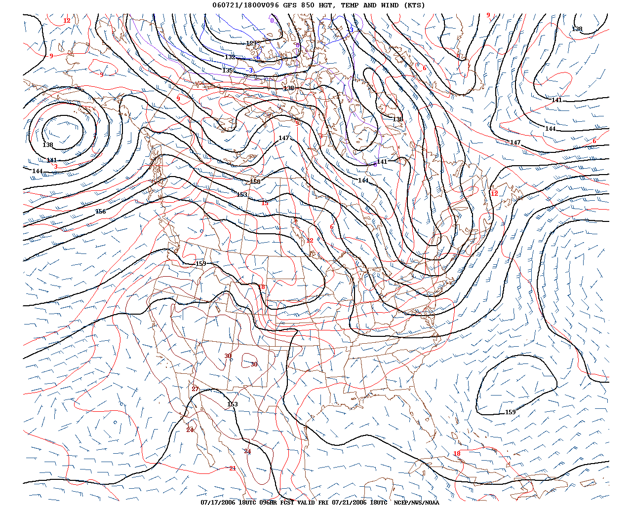
Example de carte produite par le GFS, prévision du
géopotentiel et de la température de
850 hPa valide dans 96 heures du moment d'initilisation
Le Global Forecast System (GFS) est un modèle de prévision numérique du temps du National Weather Service des États-Unis. Comme son nom l'indique, il fait ses calculs en utilisant les données météorologiques sur une grille qui recouvre toute la Terre. Ce modèle numérique est initialisé quatre fois par jour : 5h40, 11h40, 17h40 et 23h40. Le calcul pour une prévision météorologique complète, jusqu'à seize jours, dure environ 1h30. La résolution spatio-temporelle des calculs diminue avec le temps de prévision et au-delà de sept jours, les résultats ne sont utiles que comme tendance.
Fonctionnement
Les calculs du GFS s'effectuent en deux phases : haute résolution des mailles de grille de données jusqu'à 180 heures et faible résolution de 180 à 383 heures. Dans la première phase, le modèle divise la surface de la Terre en carrés de 30 km de côtés et divise l’atmosphère terrestre en 64 niveaux en altitude. Dans la seconde phase, la résolution horizontale n'est que de70 km. Les calculs sont fait selon un pas de temps qui varie avec la phase. Il crée une matrice de donnée de résultats pour chaque trois heures de prévisions dans la première phase et pour chaque douze heures de prévision dans la seconde.
Disponibilité
C'est le seul modèle global américain dont les sorties numériques sont disponibles gratuitement en temps réel. Il est donc utilisé par les compagnies privées de météorologie, comme AccuWeather et MeteoMedia, comme entrant dans leur prévision.
Voir aussi
Articles connexes
Lien externe
Wikimedia Foundation.
2010.
Contenu soumis à la licence CC-BY-SA. Source : Article Global Forecast System de Wikipédia en français (auteurs)
Regardez d'autres dictionnaires:
Global Forecast System — The Global Forecast System (GFS) is global numerical weather prediction computer model run by NOAA. This mathematical model is run four times a day and produces forecasts up 16 days in advance, but with decreasing spatial and temporal resolution… … Wikipedia
Global Environmental Multiscale Model — The Global Environmental Multiscale Model (GEM) is an integrated forecasting and data assimilation system developed in the Recherche en Prévision Numérique (RPN), Meteorological Research Branch (MRB), and the Canadian Meteorological Center… … Wikipedia
global warming — an increase in the earth s average atmospheric temperature that causes corresponding changes in climate and that may result from the greenhouse effect. [1975 80] * * * Potential increase in global average surface temperatures resulting from… … Universalium
Global Energy and Water Cycle Experiment — The Global Energy and Water Cycle Experiment (GEWEX) is a research program of the World Climate Research Programme intended to observe, comprehend and models the Earth s water cycle. The experiment also observes how much energy the Earth receives … Wikipedia
Tropical cyclone forecast model — [ National Hurricane Center (NHC)] A tropical cyclone forecast model is a computer program that uses meteorological data to forecast the motion and intensity of tropical cyclones. Such models utilize powerful supercomputers with sophisticated… … Wikipedia
Global climate model — AGCM redirects here. For Italian competition regulator, see Autorità Garante della Concorrenza e del Mercato. Climate models are systems of differential equations based on the basic laws of physics, fluid motion, and chemistry. To “run” a model,… … Wikipedia
Global warming — This article is about the change in climate Earth is currently experiencing. For general discussion of how Earth s climate can change, see Climate change … Wikipedia
Global Atmosphere Watch — The Global Atmosphere Watch (GAW) is a worldwide system established by the World Meteorological Organizationndash a United Nations agencyndash to monitor trends in the Earth s atmosphere. It arose out of concerns for the state of the atmosphere… … Wikipedia
world area forecast center — A meteorological center designated to prepare and supply upper air forecasts in digital form on a global basis to regional area forecast centers (ICAO). A contracting state, having accepted the responsibility for providing a WAFC within the… … Aviation dictionary
Satellite Distribution System — The Satellite Distribution System (SADIS) is a worldwide satellite based broadcast system dedicated to primarily distributing aeronautical meteorological information in line with ICAO (International Civil Aviation Organisation) standards.… … Wikipedia