- Gebroth
-
Gebroth 
Panorama

Administration Toponyme officiel Gebroth Pays  Allemagne
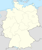
Land  Rhénanie-Palatinat
Arrondissement
(Landkreis)Arrondissement de Bad Kreuznach Code communal
(Gemeindeschlüssel)07 1 33 033 Code postal 55595 Indicatif téléphonique 06756 Immatriculation KH Site web http://www.gebroth.eu/ Politique Bourgmestre
(Ortsbürgermeister)Manfred Metzler Partis au pouvoir Géographie Coordonnées Altitude (NN) 360 m Superficie 2.36 km2 Démographie Population 155 hab. (31/12/2008) Densité 66 hab./km2 modifier 
Gebroth est une municipalité allemande située dans le land de Rhénanie-Palatinat et l'Arrondissement de Bad Kreuznach.
Catégorie :- Commune de Rhénanie-Palatinat


Wikimedia Foundation. 2010.