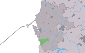
Gaast
Contenu soumis à la licence CC-BY-SA. Source : Article Gaast de Wikipédia en français (auteurs)
Regardez d'autres dictionnaires:
Koenraad van der Gaast — Dieser Artikel wurde auf den Seiten der Qualitätssicherung eingetragen. Bitte hilf mit, ihn zu verbessern, und beteilige dich bitte an der Diskussion! Folgendes muss noch verbessert werden: Bessere Babelfishvariante rettbar? Kaisersoft… … Deutsch Wikipedia
Bahnhof Eindhoven — Eindhoven Haupteingang des Bahnhofs Daten Betriebsart Durchgangsbahnhof Bahnsteiggleise … Deutsch Wikipedia
De iisfugel — (Gaast,Нидерланды) Категория отеля: Адрес: Zeedijk 5 A, 8757 JV Gaast, Нидерланды … Каталог отелей
BitlBee — Infobox Software name = BitlBee caption = Screenshot of Irssi IRC client connected to a Bitlbee server to communicate via Windows Live developer = BitlBee team, with Wilmer van der Gaast as Lead Developer released = 2002 08 09 frequently updated … Wikipedia
ABT-510 — is a molecular therapeutic drug used to treat cancer. According to the Journal of Clinical Oncology , ABT 510 is a subcutaneously (SC) administered nonapeptide thrombospondin analogue in phase 2 clinical development for treatment of advanced… … Wikipedia
Bahnhof Leiden Lammenschans — Dieser Artikel wird evtl. gelöscht, er wurde vorsichtshalber in das Verkehrs Wiki exportiert. Lady Whistler … Deutsch Wikipedia
Grootegast — Infobox Settlement official name = Grootegast mapsize = 280px subdivision type = Country subdivision name = Netherlands subdivision type1 = Province subdivision name1 = Groningen area footnotes = (2006) area total km2 = 87.78 area land km2 =… … Wikipedia
Lutjegast — is a village in the Westerkwartier area of Groningen in the Netherlands. It is administered as part of Grootegast.(In the Groningen dialect of Dutch Lutje means small or little. A gast or gaast is a higher, sandy ridge in an otherwise swampy area … Wikipedia
List of places in the Netherlands — This is an alphabetical list of places (cities, towns, villages) in the Netherlands. Lists per province can be found at:* List of towns in Groningen * List of towns in Friesland * List of towns in Drente * List of towns in Overijssel * List of… … Wikipedia
Wûnseradiel — Infobox City official name = Wûnseradiel other name = Wonseradeel mapsize = 280px subdivision type = Country subdivision name = Netherlands subdivision type1 = Province subdivision name1 = Fryslân area footnotes = (2006) area total km2 = 317.68… … Wikipedia
 Pays-Bas