Fort Kent
- Fort Kent
-
47° 14′ 55″ N 68° 34′ 55″ W / 47.248611, -68.581944
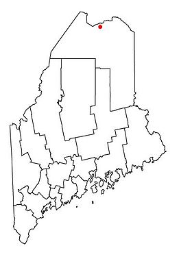
Fort Kent est une ville située dans l’État américain du Maine, dans le comté de Aroostook.
Population
Selon le recensement de 2000, sa population est de 4 233 habitants. On estime que 62 % de la population parle le français[1].
Géographie
Cette section est vide, insuffisamment détaillée ou incomplète.
Votre aide est la bienvenue !
Histoire
Cette section est vide, insuffisamment détaillée ou incomplète.
Votre aide est la bienvenue !
Économie
Cette section est vide, insuffisamment détaillée ou incomplète.
Votre aide est la bienvenue !
Culture
Cette section est vide, insuffisamment détaillée ou incomplète.
Votre aide est la bienvenue !
Monuments et patrimoine
Cette section est vide, insuffisamment détaillée ou incomplète.
Votre aide est la bienvenue !
Notes et références
Wikimedia Foundation.
2010.
Contenu soumis à la licence CC-BY-SA. Source : Article Fort Kent de Wikipédia en français (auteurs)
Regardez d'autres dictionnaires:
Fort Kent — Fort Kent … Deutsch Wikipedia
Fort Kent — may refer to: *Fort Kent, Maine, town in Maine, U.S.A. *Fort Kent (fort), fort in Maine, U.S.A … Wikipedia
Fort Kent — Fort Kent, ME U.S. Census Designated Place in Maine Population (2000): 1978 Housing Units (2000): 940 Land area (2000): 3.238587 sq. miles (8.387902 sq. km) Water area (2000): 0.076691 sq. miles (0.198628 sq. km) Total area (2000): 3.315278 sq.… … StarDict's U.S. Gazetteer Places
Fort Kent, ME — U.S. Census Designated Place in Maine Population (2000): 1978 Housing Units (2000): 940 Land area (2000): 3.238587 sq. miles (8.387902 sq. km) Water area (2000): 0.076691 sq. miles (0.198628 sq. km) Total area (2000): 3.315278 sq. miles (8.586530 … StarDict's U.S. Gazetteer Places
Fort Kent — ▪ Maine, United States town, Aroostook county, northern Maine, U.S. It lies at the confluence of the St. John (Saint John River) and Fish rivers, 50 miles (80 km) north northwest of Presque Isle, and includes the communities of Fort Kent… … Universalium
Fort Kent — Original name in latin Fort Kent Name in other language State code US Continent/City America/New York longitude 47.25865 latitude 68.58949 altitude 168 Population 2488 Date 2011 05 14 … Cities with a population over 1000 database
Fort Kent (Maine) — Fort Kent DEC … Deutsch Wikipedia
Fort Kent (Maine) — Fort Kent Fort Kent Pays États Unis État … Wikipédia en Français
Fort Kent, Maine — Infobox Settlement official name = Fort Kent, Maine settlement type = Town nickname = motto = The Little Town That Could (stemming from a local during the 2004 Biathlon World Cup) imagesize = 197x147px image caption = Downtown Fort Kent image… … Wikipedia
Fort Kent (fort) — Infobox nrhp | name =Fort Kent nrhp type = nhl caption = nearest city= Fort Kent, Maine lat degrees = 47 lat minutes = 15 lat seconds = 9 lat direction = N long degrees = 68 long minutes = 35 long seconds = 27 long direction = W locmapin = Maine… … Wikipedia

 États-Unis
 Maine
Maine