Elkerzee
Contenu soumis à la licence CC-BY-SA. Source : Article Elkerzee de Wikipédia en français (auteurs)
Regardez d'autres dictionnaires:
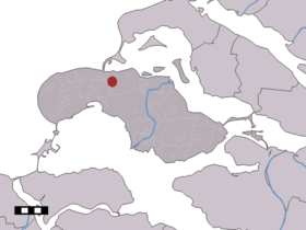
Elkerzee — Dutch town locator maps mun town caption = Elkerzee in the municipality of Schouwen Duiveland.Elkerzee (coord|51|44|N|3|51|E|type:city(100)) is a hamlet in the Dutch province of Zeeland. It is a part of the municipality of Schouwen Duiveland, and … Wikipedia
Ellemeet — 51°43′47″N 3°48′59″E / 51.72972, 3.81639 … Wikipédia en Français
Kerkwerve — 51°41′7″N 3°53′56″E / 51.68528, 3.89889 … Wikipédia en Français
Schouwen-Duiveland — Héraldique … Wikipédia en Français
Schouwen-duiveland — Schouwen Duiveland … Wikipédia en Français
Motas castrales en Zelanda — En la provincia de Zelanda, en Países Bajos, se ha descubierto un gran número de motas castrales, pequeños asentamientos defensivos situados sobre afloramientos o colinas de escasa elevación. Esta tipología de castillos tuvo un importante… … Wikipedia Español
Schouwen-Duiveland — Infobox Settlement official name = Schouwen Duiveland mapsize = 280px subdivision type = Country subdivision name = Netherlands subdivision type1 = Province subdivision name1 = Zeeland area footnotes = (2006) area total km2 = 488.94 area land km2 … Wikipedia
Kinderdijk — Coordinates: 51°53′N 4°38′E / 51.883°N 4.633°E / 51.883; 4.633 … Wikipedia
List of places in the Netherlands — This is an alphabetical list of places (cities, towns, villages) in the Netherlands. Lists per province can be found at:* List of towns in Groningen * List of towns in Friesland * List of towns in Drente * List of towns in Overijssel * List of… … Wikipedia
De Adriaan, Haarlem — Windmill De Adriaan De Adriaan is a windmill in the Netherlands that burnt down in 1932 and was rebuilt in 2002. The original windmill dates from 1779 and the mill has been a distinctive part of the skyline of Haarlem for centuries. Contents … Wikipedia
 Pays-Bas