Echtenerbrug
Contenu soumis à la licence CC-BY-SA. Source : Article Echtenerbrug de Wikipédia en français (auteurs)
Regardez d'autres dictionnaires:
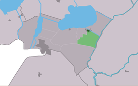
Echtenerbrug — Infobox Settlement official name = Echtenerbrug mapsize = 280px subdivision type = Country subdivision name = flagicon|Netherlands Netherlands subdivision type1 = Province subdivision name1 = flagicon|Friesland Friesland settlement type = Village … Wikipedia
Echtenerbrug — Original name in latin Echtenerbrug Name in other language Echterbrug State code NL Continent/City Europe/Amsterdam longitude 52.87141 latitude 5.82147 altitude 0 Population 1200 Date 2008 01 23 … Cities with a population over 1000 database
Ychtenbrêge — Echtenerbrug 52°52′16″N 5°49′16″E / 52.87111, 5.82111 … Wikipédia en Français
Delfstrahuizen — 52°52′30″N 5°49′32″E / 52.875, 5.82556 … Wikipédia en Français
Dolsterhuzen — Delfstrahuizen 52°52′30″N 5°49′32″E / 52.875, 5.82556 … Wikipédia en Français
Lemsterland — Infobox Settlement official name = Lemsterland image seal size = 70px mapsize = 280px subdivision type = Country subdivision name = Netherlands subdivision type1 = Province subdivision name1 = Friesland area footnotes = (2006) area total km2 =… … Wikipedia
List of places in the Netherlands — This is an alphabetical list of places (cities, towns, villages) in the Netherlands. Lists per province can be found at:* List of towns in Groningen * List of towns in Friesland * List of towns in Drente * List of towns in Overijssel * List of… … Wikipedia
Lemsterland — Gemeinde Lemsterland Flagge Wappen Provinz Friesland … Deutsch Wikipedia
Bantega — 52°50′32″N 5°47′47″E / 52.84222, 5.79639 … Wikipédia en Français
Bantegea — Bantega 52°50′32″N 5°47′47″E / 52.84222, 5.79639 … Wikipédia en Français
 Pays-Bas