- District de Canterbury
-
District de Canterbury 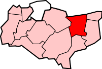
Géographie Status: Cité
BoroughRégion: Angleterre du Sud-Est Comté: Kent Comté historique: Superficie:
- TotalClassé 153e
308,84 km²Centre administatif: Cantorbéry Code ONS: 29UC Démographie Population:
-Total (2010)
-DensitéClassé 122e
153.200
496 / km²Ethnicité: 96.6% Blancs
2.2% Asiatique
1.6% Chinoise ou autre
1.4% MétissePolitique District de Canterbury
http://www.canterbury.gov.uk/Leadership: Leader & Cabinet Exécutif : Conservateur MPs: Julian Brazier
Roger GaleLe district de Canterbury ou la cité de Canterbury est un district non-métropolitain du comté de Kent en Angleterre. Le district a le statut de cité. La ville principale du district est Cantorbéry. La ville est le siège de l’archevêque de Canterbury.
Le district a été formé le 1er avril 1974 lors de la fusion de Cantorbéry avec les villes de Whitstable et de Herne Bay.
Liste des 26 paroisses constituant le district
- Adisham
- Barham
- Bekesbourne with Patrixbourne
- Bishopsbourne
- Blean
- Bridge
- Chartham
- Chestfield
- Chislet
- Fordwich (ville)
- Hackington
- Harbledown
- Herne and Broomfield
- Hoath
- Ickham
- Kingston
- Littlebourne
- Lower Hardres
- Petham
- Sturry
- Thanington Without
- Upper Hardres
- Waltham
- Westbere
- Wickhambreaux
- Womenswold
Géographie
La zone est assez rurale bien que la côte est en grande partie recouverte de localités reliées sans discontinuité comme Whitstable et Herne Bay. Entre ces villes côtières et la ville principale de Canterbury, la zone est constituée de collines boisées parcourue par la rivière Great Stour.
Liens externes
Catégorie :- District non-métropolitain du Kent

Wikimedia Foundation. 2010.