Ököritófülpös
- Ököritófülpös
-
Ököritófülpös est un village et une commune du comitat de Szabolcs-Szatmár-Bereg en Hongrie.
Géographie
Cette section est vide, insuffisamment détaillée ou incomplète.
Votre aide est la bienvenue !
Histoire
Cette section est vide, insuffisamment détaillée ou incomplète.
Votre aide est la bienvenue !
Catégorie :
- Ville et village du comitat de Szabolcs-Szatmár-Bereg
Wikimedia Foundation.
2010.
Contenu soumis à la licence CC-BY-SA. Source : Article Ököritófülpös de Wikipédia en français (auteurs)
Regardez d'autres dictionnaires:
Ököritófülpös — Country Hungary County Szabolcs Szatmár Bereg Area – Total 33.43 km2 … Wikipedia
Okoritofulpos — Original name in latin kritflps Name in other language Fulpos, Flps, Okoritofulpos, Szatmarokorito, Szatmrkrit kritflps State code HU Continent/City Europe/Budapest longitude 47.91862 latitude 22.5081 altitude 115 Population 2034 Date 2012 01 18 … Cities with a population over 1000 database
Экёритофюльпёш — Посёлок Экёритофюльпёс венг. Ököritófülpös Герб … Википедия
March 27 — << March 2011 >> Su Mo Tu We Th Fr Sa 1 2 3 … Wikipedia
1910 — This article is about the year 1910. Millennium: 2nd millennium Centuries: 19th century – 20th century – 21st century Decades: 1880s 1890s 1900s – 1910s – 1920s … Wikipedia
List of historic fires — This is a list of historic fires. Before the 20th century, fires were a major hazard to urban areas and the cause of massive amounts of damage to cities. While a few of the most important wildfires or forest fires are included, this list is not… … Wikipedia
Nyíregyháza — City center … Wikipedia
Szabolcs-Szatmár-Bereg County — Infobox Hungarian county name =Szabolcs Szatmár Bereg region =Northern Great Plain seat = Nyíregyháza area = 5936 population = 572,423 density = 96 cities = 228Szabolcs Szatmár Bereg is an administrative county (Hungarian: megye ) in north… … Wikipedia
Máriapócs — Country Hungary County Szabolcs Szatmár Bereg Area Total 22.09 km2 (8 … Wikipedia
Nagykálló — Country Hungary County Szabolcs Szatmár Bereg Area – Total 68.55 km2 (26 … Wikipedia


 Hongrie
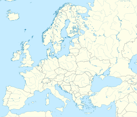

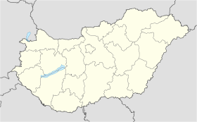
 Ököritófülpös


