- Wilhelmsfeld
-
Wilhelmsfeld 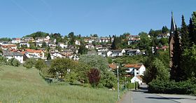


Administration Toponyme officiel Pays  Allemagne
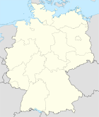
Land  Bade-Wurtemberg
District
(Regierungsbezirk)District de Karlsruhe Arrondissement
(Landkreis)Arrondissement de Rhin-Neckar Code communal
(Gemeindeschlüssel)08 2 26 099 Code postal 69259 Indicatif téléphonique 06220 Immatriculation HD Site web www.wilhelmsfeld.de Politique 2009-2014 Bourgmestre
(Bürgermeister)Hans Zellner Partis au pouvoir Géographie Coordonnées Altitude (NN) 280 - 530 m Superficie 4.75 km2 Démographie Population 3223 hab. (2009-12-31) Densité 679 hab./km2 modifier 
Wilhelmsfeld est une commune de Bade-Wurtemberg (Allemagne), située dans l'arrondissement de Rhin-Neckar, dans l'aire urbaine Rhin-Neckar, dans le district de Karlsruhe.Catégorie :- Commune de Bade-Wurtemberg


Wikimedia Foundation. 2010.