Popilnia

Popilnia
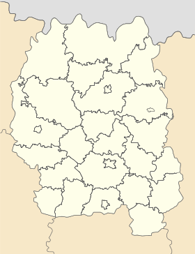
Popilnia
Попільня

Géolocalisation sur la carte : Oblast de Jytomyr

(Voir situation sur carte : Oblast de Jytomyr)
Popilnia

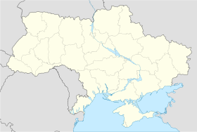
Géolocalisation sur la carte : Ukraine

(Voir situation sur carte : Ukraine)
Popilnia
Coordonnées : 49°56′45″N 29°27′34″E / 49.94583, 29.4594449°56′45″N 29°27′34″E / 49.94583, 29.45944
Pays Drapeau d'Ukraine Ukraine
Subdivision Flag of Zhytomyr Oblast.svg Oblast de Jytomyr
Raïon Popelnianskii rayon fl.gif Popilnia
Fondation 1600
Statut commune urbaine depuis 1938
Population en diminution 6 028 hab. (2011)
Densité 1 399 hab./km²
Superficie 4,31 km2
Indicatif tél. +380 4137
Code postal 13503
Liste des villes d'Ukraine | Carte

Popilnia (en ukrainien : Попільня) ou Popelnia (en russe : Попельня) est une commune urbaine de l'oblast de Jytomyr, en Ukraine, et le centre administratif du raion de Popilnia. Sa population s'élevait à 6 028 habitants en 2011.

Sommaire

Géographie

Popilnia se trouve à 68 km au sud-est de Jytomyr et à 97 km au sud-ouest de Kiev.

Histoire

Popilnia a été fondée en 1600. Elle a le statut de commune urbaine depuis 1938.

Population

Recensements (*) ou estimations de la population [1] :

Évolution démographique
1959* 1970* 1979* 2001* 2008 2009 2010 2011
2 631 4 281 5 208 6 109 6 068 6 070 6 055 6 028

Transports

Popilnia se trouve à 132 km de Jytomyr par le chemin de fer et 72 km par la route.

Notes et références

  1. (ru) Recensements de 1959, 1970 et 1979 sur www.webgeo.ru(uk) Office des statistiques d'Ukraine : Статистичний збірник «Чисельність наявного населення України на 1 січня 2008 року» [Manuel statistique « Nombre d'habitants de l'Ukraine au 1er janvier 2008 »]. [1] ; Статистичний збірник «Чисельність наявного населення України на 1 січня 2010 року» [Manuel statistique « Nombre d'habitants de l'Ukraine au 1er janvier 2010 »]. [2] ; Статистичний збірник «Чисельність наявного населення України на 1 січня 2011 року» [Manuel statistique « Nombre d'habitants de l'Ukraine au 1er janvier 2011 »]. [3]

Liens externes


Wikimedia Foundation. 2010.

Contenu soumis à la licence CC-BY-SA. Source : Article Popilnia de Wikipédia en français (auteurs)

Игры ⚽ Нужен реферат?

Regardez d'autres dictionnaires:

  • Kornyn — Корнин Géolocalisation sur la carte : Oblast de Jytomyr …   Wikipédia en Français

  • Ovruch — Coordinates: 51°19′N 28°48′E / 51.317°N 28.8°E / 51.317; 28.8 Ovruch (Ukrainian …   Wikipedia

  • Novohrad-Volynskyi — Coat of arms of Novohrad Volynskyi Novohrad Volynskyi (historical spellings: Возвягель Vozbyahrel’, Звяголь Zvyahol’, Звягель Zvyahel’, Звягаль Zvyahal’; modern: Ukrainian: Новоград Волинський, translit.: Novohrad Volyns’kyi; Russian: Новоград… …   Wikipedia

  • Radomyshl — (Ukrainian: Радомишль, translit., Radomyshl’) is a historic city in the Zhytomyr Oblast (province) of northern Ukraine. It is the administrative center of the Radomyshl Raion (district), and is located on the left bank of Teteriv River, a right… …   Wikipedia

  • Chudniv — Napoleon Orda Chudniv (Ukrainian: Чуднів) is a town (urban type settlement) in Chudniv Raion, Zhytomyr Oblast …   Wikipedia

  • Malyn — For the village in Poland, see Małyń. Malyn (Ukrainian: Малин, Malyn) (sometimes spelled Malin) is a city in Zhytomyr Oblast (province) of Ukraine located about 65 miles (100 km) northwest of Kiev. Population is 28,113 (2001). The town hosts a… …   Wikipedia

  • Olevsk — (Ukrainian: Олевськ, translit. Olevs’k) is a city in Olevsk Raion, Zhytomyr Oblast, Ukraine. It is the administrative center of the Olevsk Raion. The population was 10,896 (as of 2001).  Administrative divisions of Zhytomyr Oblast, Ukraine …   Wikipedia

  • Ozerne (Zhytomyr Oblast) — Ozerne (Ukrainian: Озерне) is a town (urban type settlement) in Zhytomyr Raion, Zhytomyr Oblast, Ukraine. The population was 5,913 (as of 2001). It s home to a military air base.  Administrative divisions of Zhytomyr Oblast, Ukraine …   Wikipedia

  • Androuchivka — Андрушівка …   Wikipédia en Français

  • Baranivka — Баранівка …   Wikipédia en Français

Share the article and excerpts

Direct link
Do a right-click on the link above
and select “Copy Link”