Pinsdorf
Contenu soumis à la licence CC-BY-SA. Source : Article Pinsdorf de Wikipédia en français (auteurs)
Regardez d'autres dictionnaires:
Pinsdorf — Pinsdorf … Deutsch Wikipedia
Pinsdorf — Infobox Town AT name=Pinsdorf name local= image coa = Wappen at pinsdorf.png state = Upper Austria district = Gmunden population =3523 population as of = 01.01.2004 population ref = pop dens =276 area = 12.47 elevation = 493 lat deg=47 lat min=55 … Wikipedia
Liste der denkmalgeschützten Objekte in Pinsdorf — Die Liste der denkmalgeschützten Objekte in Pinsdorf enthält die denkmalgeschützten, unbeweglichen Objekte der Gemeinde Pinsdorf im oberösterreichischen Bezirk Gmunden, wobei die Objekte teilweise per Bescheid und teilweise durch Verordnung… … Deutsch Wikipedia
Aurach (Ager) — AurachVorlage:Infobox Fluss/GKZ fehlt Lage Oberösterreich Flusssystem Donau Abfluss über Ager → Traun → Donau → … Deutsch Wikipedia
Gmunden am Traunsee — Wappen Karte … Deutsch Wikipedia
Gmundner Verkehrsverbund — Wappen Karte … Deutsch Wikipedia
Haus Bammer — (Pinsdorf,Австрия) Категория отеля: Адрес: 4812 Pinsdorf, Австрия Опи … Каталог отелей
Aurach River — Aurach is a river in the Austrian state of Upper Austria. It originates in the area of the mountain Hochleckengebiet in the Höllengebirge and flows through the wooden rich valley Aurachtal, that spreads through the communities of Altmünster… … Wikipedia
Altmünster — Altmünster … Deutsch Wikipedia
B 145 — 145 Basisdaten Name: Salzkammergut Straße Gesamtlänge: 98 km Bundesländer: Steiermark Oberösterreich Verlaufsri … Deutsch Wikipedia

 Autriche
 Haute-Autriche
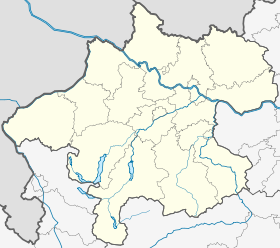


 Pinsdorf


