Möhrendorf

Möhrendorf
Möhrendorf
Pas de blason défini
Germany location map.svg
Möhrendorf
Administration
Toponyme officiel
Pays Drapeau d'Allemagne Allemagne
Land Bavière Bavière
District
(Regierungsbezirk)
Moyenne-Franconie
Arrondissement
(Landkreis)
Arrondissement d'Erlangen-Höchstadt
Code communal
(Gemeindeschlüssel)
Code postal
Indicatif téléphonique
Immatriculation
Politique
Bourgmestre
(Bürgermeister)
Partis au pouvoir
Géographie
Coordonnées 49° 38′ 00″ N 11° 00′ 00″ E / 49.6333, 1149° 38′ 00″ Nord
       11° 00′ 00″ Est
/ 49.6333, 11
  
Altitude (NN)  m
Superficie  km2
Démographie
Population  hab. ()
Densité  hab./km2

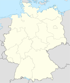
Möhrendorf est une commune de Bavière (Allemagne), située dans l'arrondissement d'Erlangen-Höchstadt, dans le district de Moyenne-Franconie.


Wikimedia Foundation. 2010.

Contenu soumis à la licence CC-BY-SA. Source : Article Möhrendorf de Wikipédia en français (auteurs)

Игры ⚽ Нужно решить контрольную?

Regardez d'autres dictionnaires:

  • Möhrendorf — Möhrendorf …   Wikipedia

  • Möhrendorf — Wappen Deutschlandkarte …   Deutsch Wikipedia

  • Mohrendorf — Original name in latin Mhrendorf Name in other language Mohrendorf, Mhrendorf State code DE Continent/City Europe/Berlin longitude 49.63333 latitude 11 altitude 272 Population 4349 Date 2011 07 31 …   Cities with a population over 1000 database

  • Nister-Möhrendorf — Nister Möhrendorf …   Wikipedia

  • Nister-Möhrendorf — Wappen Deutschlandkarte …   Deutsch Wikipedia

  • Nister-Möhrendorf — Nister Möhrendorf …   Wikipédia en Français

  • Kleinseebach — Wappen Deutschlandkarte …   Deutsch Wikipedia

  • Erlanger Stadtwerke — Wappen Deutschlandkarte …   Deutsch Wikipedia

  • Erlanger Tanz- & Folkfest — Wappen Deutschlandkarte …   Deutsch Wikipedia

  • Stadt-Umland-Bahn Erlangen — Wappen Deutschlandkarte …   Deutsch Wikipedia

Share the article and excerpts

Direct link
Do a right-click on the link above
and select “Copy Link”