Leányvár
- Leányvár
-
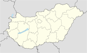
Leányvár est un village et une commune du comitat de Komárom-Esztergom en Hongrie.
Géographie
Cette section est vide, insuffisamment détaillée ou incomplète.
Votre aide est la bienvenue !
Histoire
Cette section est vide, insuffisamment détaillée ou incomplète.
Votre aide est la bienvenue !
Catégorie :
- Ville et village du comitat de Komárom-Esztergom
Wikimedia Foundation.
2010.
Contenu soumis à la licence CC-BY-SA. Source : Article Leányvár de Wikipédia en français (auteurs)
Regardez d'autres dictionnaires:
Leányvár — Infobox Settlement subdivision type = Country subdivision name = HUN timezone=CET utc offset=+1 timezone DST=CEST utc offset DST=+2|official name=Leányvár subdivision type1=County subdivision name1=Komárom Esztergom area total km2=7.25 population … Wikipedia
Leányvár Fogadó Étterem és Panzió — (Рацкеве,Венгрия) Категория отеля: Адрес: 2300 Рацкеве, Külterüle … Каталог отелей
Kastell Baracspuszta — Karte mit allen Koordinaten: OSM, Google oder … Deutsch Wikipedia
Celemantia — (or Kelemantia; the modern name of the site is Leányvár) was a Roman castellum and settlement on the territory of the present day municipality Iža (Hun: Izsa ), some 4 km to the east of Komárno. It is the biggest known Roman castellum in present… … Wikipedia
Liste deutscher Bezeichnungen ungarischer Orte — In dieser Liste werden ungarischen Orten (Städte, Flüsse, Inseln, etc.) deren (ehemalige) deutsche Bezeichnungen gegenübergestellt, die sie aus deutschsprachiger Sicht heute noch tragen oder zu Zeiten trugen, als die Gebiete zur Donaumonarchie… … Deutsch Wikipedia
Kastell Brigetio — Alternativname Brigetio Limes Pannonischer Limes Abschnitt 1 Typ a) Kohortenkastell b) Legionslager Größe a) 200 × ? m b) 430 × 540 … Deutsch Wikipedia
Komárom-Esztergom County — Infobox Hungarian county name =Komárom Esztergom region =Central Transdanubia seat = Tatabánya area = 2265 population = 319,000 density = 142 cities = 76Komárom Esztergom is the name of an administrative county (comitatus or megye) in northern… … Wikipedia
Oroszlány — Aerial view … Wikipedia
Dorog — Town … Wikipedia
Nyergesújfalu — Nyergesújfalu … Wikipedia


 Hongrie
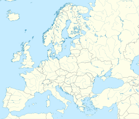

 Leányvár


