Birganj
Contenu soumis à la licence CC-BY-SA. Source : Article Birganj de Wikipédia en français (auteurs)
Regardez d'autres dictionnaires:
Birganj — is a sub metropolitan municipality and border town in southern Nepal, it lies 190 km west of the capital Kathmandu, 2 km north of the border of the Indian state of Bihar. As an entry point to Nepal from Patna and Calcutta it is also known as the… … Wikipedia
Birganj — (Nepali: वीरगञ्ज Bīrgañj), (Zensus 2001: 112.484 Einwohner) ist eine Grenzstadt im Terai im südlichen Nepal, ca. 190 km westlich von Kathmandu, 2 km nördlich der indischen Grenze und dem Grenzort Raxaul. Sie ist Verwaltungssitz des Parsa… … Deutsch Wikipedia
Birganj — Original name in latin Brganj Name in other language Birganj, Birgunj, Brganj State code NP Continent/City Asia/Kathmandu longitude 27.01043 latitude 84.87735 altitude 91 Population 133238 Date 2013 05 21 … Cities with a population over 1000 database
Birganj Upazila — Infobox of upazilas native name = Birganj locator position = right latd = 25.8597 longd = 88.6500 division name = Rajshahi Division district = Dinajpur District population as of = 1991 population total = 231305 population density = 560 area total … Wikipedia
Bīrganj — ▪ Nepal town, southern Nepal, in the Terai, a low, fertile plain, near the Indian border. Southwest of Kāthmāndu (Kathmandu), it is an important marketing centre (rice, wheat, barley, corn [maize], jute) and a terminus for the narrow gauge… … Universalium
2006 Birganj unrest — The 2006 Birganj unrest were several incidents of unrest perpetrated by Hindu groups in the Nepalese city of Birganj on 22 May 2006 following the announcement by the Parliament of Nepal on the 18 May that the country will become a secular state.… … Wikipedia
Mahendra Highway — महेन्द्र राजमार्ग Route information Length: 1,000 km (1,000 mi) Major junctions From: Kankarbhitta … Wikipedia
7-Parteien-Allianz — संघीय लोकतान्त्रिक गणतन्त्रात्मक नेपाल Saṃghīya Loktāntrik Gaṇatantrātmak Nepāl Demokratische Bundesrepublik Nepal[1] … Deutsch Wikipedia
Demokratische Bundesrepublik Nepal — संघीय लोकतान्त्रिक गणतन्त्रात्मक नेपाल Saṃghīya Loktāntrik Gaṇatantrātmak Nepāl Demokratische Bundesrepublik Nepal[1] … Deutsch Wikipedia
Königreich Nepal — संघीय लोकतान्त्रिक गणतन्त्रात्मक नेपाल Saṃghīya Loktāntrik Gaṇatantrātmak Nepāl Demokratische Bundesrepublik Nepal[1] … Deutsch Wikipedia
 Népal
Népal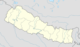
 Birganj