Baranof Lake
Contenu soumis à la licence CC-BY-SA. Source : Article Baranof Lake de Wikipédia en français (auteurs)
Regardez d'autres dictionnaires:
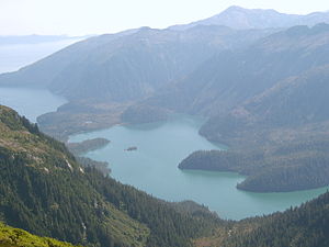
Baranof Lake — Infobox lake lake name = Baranof Lake image lake = Baranof Lake.jpg caption lake = A view southeast of the east half of Baranof Lake and part of Warm Springs Bay image bathymetry = caption bathymetry = location = Baranof Island, Sitka City and… … Wikipedia
Baranof Warm Springs, Alaska — Baranof Warm Springs is a small, primarily seasonally occupied community in the U.S. state of Alaska, located on the eastern side of Baranof Island in the Alexander Archipelago. It is occasionally referred to simply as Baranof . Baranof Warm… … Wikipedia
Baranof Warm Springs (Alaska) — Baranof Warm Springs est une localité d Alaska aux États Unis situé à l est de l Île Baranof, dans l Archipel Alexandre du Passage Intérieur, Borough de Sitka à 57°05′22″N 134°49′59″O / … Wikipédia en Français
Baranof River — is a glacially fed river on the eastern side of Baranof Island, in the Alexander Archipelago, in the Alaska Panhandle. The source of the river is from the unnamed icefields surrounding Peak 5390. Baranof River feeds into Baranof Lake, and the… … Wikipedia
Baranof Cross-Island Trail — Infobox Hiking trail Name=Baranof Cross Island Trail Photo=Bassie Icefield Late Summer.jpg Caption=A group of two crossing the icefield on Mt. Bassie. Location=Baranof Island, Alaska, United States Length=16 mi; 25 km Start/End Points=Sitka, AK;… … Wikipedia
Baranof (rivière) — 57°04′08″N 134°53′55″O / 57.06889, 134.89861 … Wikipédia en Français
Baranof Island — Gewässer Pazifischer Ozean Inselgruppe Alexand … Deutsch Wikipedia
Baranof Island — Infobox Islands name = Baranof image caption = Islands of the Pacific Northwest Coast image size = locator Location map|Alaska|lat=57.0|long= 135.0 map custom = yes native name = native name link = nickname = location = ABC islands of Alaska… … Wikipedia
List of geographic features on Baranof Island — The following is a partial list of geographic features on Baranof Island:Lakes*Baranof Lake *Blue Lake *Camp Lake *Green Lake *Indigo Lake *Medvejie Lake *Swan LakeMountains*Peak 5390 *Mount Arrowhead *Mount Bassie *Mount Furuhelm *Mount… … Wikipedia
Medvejie Lake — Looking up from the Medvejie Lake valley from near the end of the frozen over lake Location Baranof Island, Sitka, Alaska, USA … Wikipedia