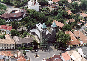
Badacsonytomaj
- Badacsonytomaj
-
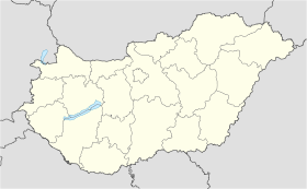
Badacsonytomaj est une ville et une commune du comitat de Veszprém en Hongrie.
Géographie
Cette section est vide, insuffisamment détaillée ou incomplète.
Votre aide est la bienvenue !
Histoire
Cette section est vide, insuffisamment détaillée ou incomplète.
Votre aide est la bienvenue !
Catégories :
- Ville et village du comitat de Veszprém
- Ville de Hongrie
Wikimedia Foundation.
2010.
Contenu soumis à la licence CC-BY-SA. Source : Article Badacsonytomaj de Wikipédia en français (auteurs)
Regardez d'autres dictionnaires:
Badacsonytomaj — Infobox Settlement subdivision type = Country subdivision name = HUN timezone=CET utc offset=+1 timezone DST=CEST utc offset DST=+2 pushpin pushpin label position = pushpin map caption =Location of Badacsonytomaj pushpin mapsize = official… … Wikipedia
Badacsonytomaj — Original name in latin Badacsonytomaj Name in other language Badacsonytomaj State code HU Continent/City Europe/Budapest longitude 46.80711 latitude 17.51385 altitude 112 Population 2271 Date 2012 01 18 … Cities with a population over 1000 database
József Egry — Badacsonytomaj József Egry (* 15. März 1883 im südwestungarischen Zalaújlak bei Nagykanizsa, Komitat Zala; † 19. Juni 1951 in Badacsonytomaj am Plattensee) war ein ungarischer Maler und Graphiker. Der Sohn von Tagelöhnern geht 1904 für einige… … Deutsch Wikipedia
Бадачоньтомай — Город Бадачоньтомай венг. Badacsonytomaj Герб … Википедия
Nemzeti Bajnokság III — NB III (Nemzeti Bajnokság III, National Championship III) is the third tier of Hungarian football (from the autumn of 1997 till the spring of 2005, NB III was the fourth tier, the third was NB II). The tier contains 6 groups of 15 16 teams. From… … Wikipedia
Lake Balaton — Infobox lake lake name = Lake Balaton image lake = Balaton Hungary Landscape.jpg caption lake = image bathymetry = caption bathymetry = location= Hungary coords = coord|46|50|N|17|44|E|type:waterbody region:HU|display=inline,title type = Rift… … Wikipedia
List of cities and towns in Hungary — Hungary This article is part of the series: Politics and government of Hungary Constitution President … Wikipedia
Veszprém (county) — Infobox Hungarian county name =Veszprém region =Central Transdanubia seat = Veszprém area = 4613 population = 375,000 density = 81 cities = 217: For the historical county see Veszprém (former county). Veszprém (in Slovak Vesprím ) is the name of… … Wikipedia
List of botanical gardens in Hungary — This is a complete list of botanical gardens in Hungary.*Alcsútdoboz arboretum *Bábolna arboretum *Badacsonytomaj, Folly Arboretum *Balatongyörök, Büdöskút arboretum *Bárdudvarnok, Kaposdada arboretum *Buda arboretum *Budakeszi arboretum… … Wikipedia
Devecser — Aerial photography: Devecser Palace … Wikipedia

 Hongrie
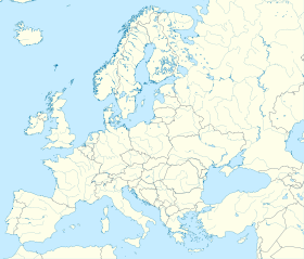

 Badacsonytomaj


