Zwaanshoek
Contenu soumis à la licence CC-BY-SA. Source : Article Zwaanshoek de Wikipédia en français (auteurs)
Regardez d'autres dictionnaires:
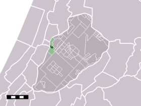
Zwaanshoek — Dutch town locator maps mun town caption = The town centre (darkgreen) and the statistical district (lightgreen) of Zwaanshoek in the municipality of Haarlemmermeer.Zwaanshoek (coord|52|19|N|4|37|E|type:city(1250)) is a town in the Dutch province … Wikipedia
Haarlemmermeer — Héraldique … Wikipédia en Français
Haarlemmermeer — Infobox Settlement official name = Haarlemmermeer imagesize = 230px image caption = Beursplein in Hoofddorp flag size = 120x100px image shield = Haarlemmermeer wapen.png shield size = 120x100px mapsize = 280px subdivision type = Country… … Wikipedia
Nieuw-Vennep — The town of Nieuw Vennep in the municipality of Haarlemmermeer … Wikipedia
List of places in the Netherlands — This is an alphabetical list of places (cities, towns, villages) in the Netherlands. Lists per province can be found at:* List of towns in Groningen * List of towns in Friesland * List of towns in Drente * List of towns in Overijssel * List of… … Wikipedia
Nieuwe Meer — in the municipality of Haarlemmermeer … Wikipedia
Oude Meer — Hamlet … Wikipedia
Aalsmeerderbrug — 52°16′N 4°45′E / 52.267, 4.75 Aalsmeerderbr … Wikipédia en Français
Aalsmeerderbuurt-Zuid — Rijsenhout Rijsenhout Vue de la localité sur la carte des Pays Bas Pays … Wikipédia en Français
Abbenes — 52°14′2″N 4°35′22″E / 52.23389, 4.58944 … Wikipédia en Français
 Pays-Bas