Verin Ptghni

Verin Ptghni

40° 16′ 13″ N 44° 36′ 04″ E / 40.270278, 44.601111

Verin Ptghni
Վերին Պտղնի
Administration
Pays Drapeau d'Arménie Arménie
Région Kotayk
Maire Gevorg Poghosyan[1]
(2008)
Géographie
Coordonnées 40° 16′ 13″ Nord
       44° 36′ 04″ Est
/ 40.270278, 44.601111
Altitude 1 400 m
Superficie 5 300 ha = 53 km2
Démographie
Population 898 hab.
Densité 16,9 hab./km2
Localisation
Voir la carte topographique
Verin Ptghni
Voir la carte administrative
Verin Ptghni

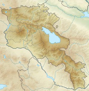
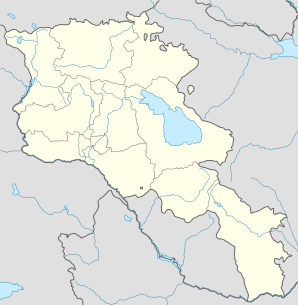
Verin Ptghni (en arménien Վերին Պտղնի) est une communauté rurale du marz de Kotayk, en Arménie. Elle compte 898 habitants en 2008[2].

Notes et références

  1. (hy+en) Central Electoral Commission of the Republic of Armenia. Consulté le 24 janvier 2011.
    Pour obtenir la page en anglais, cliquez sur le drapeau arménien en haut à gauche, et sélectionnez « English » ; ensuite, dans le menu vertical de gauche, cliquez sur « Local », sélectionnez le marz pertinent, puis la dernière élection correspondant à la communauté voulue.
  2. (en) ArmStat, Marzes of the Republic of Armenia in figures, 2008, « RA Kotayk Marz », 2008. Consulté le 8 mai 2009.

Wikimedia Foundation. 2010.

Contenu soumis à la licence CC-BY-SA. Source : Article Verin Ptghni de Wikipédia en français (auteurs)

Игры ⚽ Нужно сделать НИР?

Regardez d'autres dictionnaires:

  • Verin Ptghni — Infobox Settlement official name =Verin Ptghni Վերին Պտղնի native name = pushpin mapsize =150px subdivision type = Country subdivision name = Armenia subdivision type1 = Marz (Province) subdivision name1 =Kotayk leader title = leader name =… …   Wikipedia

  • Ptghni — 40° 15′ 24″ N 44° 35′ 06″ E / 40.256667, 44.585 …   Wikipédia en Français

  • List of municipalities of Armenia — Map of Armenia The Municipalities of Armenia are referred to as communities (համայնքներ hamaynkner, singular համայնք hamaynk ). Each community is self governing and consists of one or more settlements (bnakavayrer, singular bnakavayr).… …   Wikipedia

  • Nor Hachn — Coordinates: 40°18′07″N 44°34′59″E / 40.30194°N 44.58306°E / 40.30194; 44.58306 …   Wikipedia

  • Lernanist — 40° 28′ 03″ N 44° 47′ 53″ E / 40.4675, 44.798056 …   Wikipédia en Français

  • Hrazdan — For other places with the same name, see Hrazdan (disambiguation). Hrazdan Հրազդան Hrazdan …   Wikipedia

  • Tsaghkadzor — For the village in Azerbaijan, see Tsaxkadzor. Tsaghkadzor Ծաղկաձոր General view of the Tsaghkadzor valley …   Wikipedia

  • Charentsavan — Coordinates: 40°24′35″N 44°38′35″E / 40.40972°N 44.64306°E / 40.40972; 44.64306 …   Wikipedia

  • Arzakan — Coordinates: 40°26′58″N 44°36′23″E / 40.44944°N 44.60639°E / 40.44944; 44.60639 …   Wikipedia

  • Arzni — Coordinates: 40°17′47″N 44°35′45″E / 40.29639°N 44.59583°E / 40.29639; 44.59583 …   Wikipedia

Share the article and excerpts

Direct link
Do a right-click on the link above
and select “Copy Link”