- Sniatyn
-
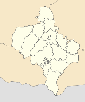
Sniatyn Снятин Géolocalisation sur la carte : Oblast d'Ivano-Frankivsk

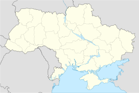
Géolocalisation sur la carte : Ukraine
Coordonnées : Pays  Ukraine
Subdivision  Oblast d'Ivano-Frankivsk
Maire Vitaliï Betsa Première mention 1158 Statut Ville depuis 1939 Population  10 175 hab. (2010)
Densité 288 hab./km² Altitude 270 m Superficie 35,29 km2 Code postal 78300 — 78304 Liste des villes d'Ukraine | Carte Sniatyn (en ukrainien : Снятин ; en russe : Снятин, Sniatine ; en polonais : Śniatyń) est une ville de l'oblast d'Ivano-Frankivsk, en Ukraine, et le centre administratif du raïon de Sniatyn. Sa population s'élevait à 10 175 habitants en 2010.
Sommaire
Géographie
Sniatyn est située sur la rive gauche de la rivière Prout, à 81 km — 108 km par la route — au sud-est d'Ivano-Frankivsk, à la limite d l'oblast de Tchernivtsi.
Histoire
 Armoiries de Sniatyn (1790)
La première mention de la ville remonte à 1158. Des privilèges urbains (droit de Magdebourg) furent accordés à Sniatyn en 1448. De la première partition de la Pologne, en 1772, à 1918, Sniatyn faisait partie du royaume d'Autriche, puis de l'Empire d'Autriche-Hongrie, tout près de la frontière de l'Empire russe. Elle redevint polonaise dans l'entre-deux-guerres et était alors un point de franchissement de la frontière entre la Pologne et la Roumanie pour le chemin de fer.
Au cours de la Seconde Guerre mondiale, elle fut d'abord envahie par l'armée roumaine, puis l'armée hongroise et enfin l'armée allemande, en septembre 1941. En octobre et décembre suivants, environs 500 Juifs furent tués dans une forêt voisine par des unités allemandes et leurs collaborateurs ukrainiens. Au début de 1942, les Juifs durent s'entasser dans un quartier de la ville formant un ghetto, où les conditions sanitaires étaient très mauvaises, et la mortalité très élevée. Le 2 avril 1942, environ 5 000 Juifs de Sniatyn et des régions voisines furent regroupés dans le lycée public, puis transportés au camp d'extermination de Belzec par train, à l'exception de quelques-uns dont la profession intéressait l'occupant. Le 7 septembre 1942, alors que le ghetto était incendié, les Juifs survivants, environ 1 500, furent à leur tour transportés à Belzec[1].
Population
Recensements (*) ou estimations de la population [2] :
Évolution démographique 1897* 1970* 1989* 2001* 2005 2006 2007 2008 2009 2010 11 000 7 200 11 213 10 479 10 301 10 285 10 267 10 218 10 218 10 175 Liens externes
- (uk) Statistiques officielles
- (en) Histoire des Juifs et de la ville de Sniatyn
- (ru) Cartes topographiques
- (ru) Carte routière
- (en) Héraldique ukrainienne
Notes et références
- (en) Histoire des Juifs de Sniatyn [1]
- (en) World Gazetteer [2] — (uk) Comité d'État de statistiques d'Ukraine : Статистичний збірник «Чисельність наявного населення України на 1 січня 2008 року» [Manuel statistique « Nombre d'habitants de l'Ukraine au 1er janvier 2008 »]. [3] ; «Статистичний збірник "Чисельність наявного населення України на 1 січня 2010 року» [Manuel statistique « Nombre d'habitants de l'Ukraine au 1er janvier 2010 »]. [4]
Catégories :- Ville d'Ukraine
- Ville de l'oblast d'Ivano-Frankivsk


Wikimedia Foundation. 2010.