Schalsum
Contenu soumis à la licence CC-BY-SA. Source : Article Schalsum de Wikipédia en français (auteurs)
Regardez d'autres dictionnaires:
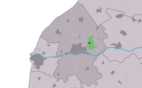
Schalsum — Infobox Settlement official name = Schalsum mapsize = 280px subdivision type = Country subdivision name = flagicon|Netherlands Netherlands subdivision type1 = Province subdivision name1 = flagicon|Friesland Friesland settlement type = Village… … Wikipedia
Skalsum — Schalsum 53°11′50″N 5°34′16″E / 53.19722, 5.57111 … Wikipédia en Français
De Hiemerter Mole, Burgwerd — De Heimerter Mole, Burgwerd De Heimerter Mole, September 2008 Origin Mill name De Heimerter Mole … Wikipedia
Franekeradeel — Infobox Settlement official name = Franekeradeel image seal size = 70px mapsize = 280px subdivision type = Country subdivision name = Netherlands subdivision type1 = Province subdivision name1 = Friesland area footnotes = (2006) area total km2 =… … Wikipedia
Kinderdijk — Coordinates: 51°53′N 4°38′E / 51.883°N 4.633°E / 51.883; 4.633 … Wikipedia
List of places in the Netherlands — This is an alphabetical list of places (cities, towns, villages) in the Netherlands. Lists per province can be found at:* List of towns in Groningen * List of towns in Friesland * List of towns in Drente * List of towns in Overijssel * List of… … Wikipedia
De Adriaan, Haarlem — Windmill De Adriaan De Adriaan is a windmill in the Netherlands that burnt down in 1932 and was rebuilt in 2002. The original windmill dates from 1779 and the mill has been a distinctive part of the skyline of Haarlem for centuries. Contents … Wikipedia
Franekeradeel — Gemeinde Franekeradeel Flagge Wappen Provinz Friesland … Deutsch Wikipedia
Frjentsjerteradiel — Gemeinde Franekeradeel Flagge Wappen Provinz … Deutsch Wikipedia
Achlum — 53°8′53″N 5°29′6″E / 53.14806, 5.485 … Wikipédia en Français
 Pays-Bas