- Sayalonga
-
Sayalonga 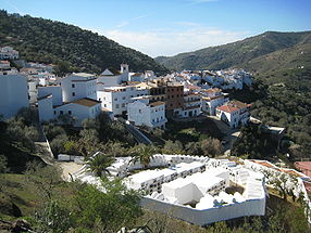
Vue du village. Au premier plan, le cimetière rond. 
Drapeau Blason 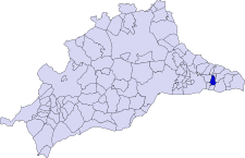
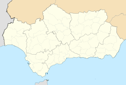
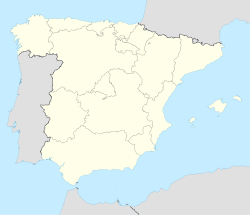
Géolocalisation sur la carte : Andalousie

Géolocalisation sur la carte : Espagne
Données générales Statut Municipio Pays  Espagne
Communauté autonome  Andalousie
Province  Province de Málaga
Comarque La Axarquía District judic. Torrox Code postal 29 752 Gentilé sayalonguino/a Données géographiques Coordonnées Superficie 18 km2 Altitude moy. 359 m Distance(s) Sayalonga est à 538 km de Madrid. Population (INE)
- total :
- densité :
- année :
1 532 hab.
85.11 hab./km2
2008Rivière(s) Algarrobo Politique Maire
- parti
- mandatJose Luís Navas Camacho
PSOE
2007-2011Budget
- montant :
- année :
2 348 042,05 €
2007Site web www.sayalonga.es Culture Saint patron Nuestra Señora del Rosario modifier 
Sayalonga est une commune de la province de Málaga, en Andalousie, Espagne, située dans la comarque d'Axarquía. Sur son territoire se situe l'écart de Corumbela, qui compte 300 habitants.
Le village est situé sur la vallée du rio Algarrobo, entre Algarrobo et Cómpeta.
Histoire et monuments
Phéniciens, Romains, Arabes se succédèrent dans le village, mettant en valeur le relief schisteux par le biais de terrasses et de l'irrigation gravitaire (acequías).
La période musulmane (711-1487) a laissé des vestiges importants :
- le minaret arabe de Corumbela, datant du XIIe siècle;
- le réservoir de Ventorillo de la Aljibe, pouvant contenir 90 000 litres;
- le cimetière rond, unique en Espagne, datant du XVIe siècle - donc l'époque chrétienne - mais dont on trouve des exemples similaires en Kabylie notamment;
- le village, avec ses maisons blanches caractéristiques.
Activités
Sayalonga est un village agricole. Sur ses terrasses se cultivent l'amandier, la vigne, l'olivier, le caroubier, les légumes secs. Le village s'est autoproclamé Paradis des nèfles.
Le tourisme est également une activité importante. Sayalonga est située à 8 km de la mer Méditerranée, sur la Costa del Sol.
Catégorie :- Commune de la province de Málaga


Wikimedia Foundation. 2010.