Reitsum
Contenu soumis à la licence CC-BY-SA. Source : Article Reitsum de Wikipédia en français (auteurs)
Regardez d'autres dictionnaires:
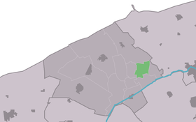
Reitsum — Infobox Settlement official name = Reitsum mapsize = 280px subdivision type = Country subdivision name = flagicon|Netherlands Netherlands subdivision type1 = Province subdivision name1 = flagicon|Friesland Friesland settlement type = Village… … Wikipedia
Ferwerderadiel — Infobox Settlement official name = Ferwerderadiel image seal size = 70px mapsize = 280px subdivision type = Country subdivision name = Netherlands subdivision type1 = Province subdivision name1 = Friesland area footnotes = (2006) area total km2 … Wikipedia
List of places in the Netherlands — This is an alphabetical list of places (cities, towns, villages) in the Netherlands. Lists per province can be found at:* List of towns in Groningen * List of towns in Friesland * List of towns in Drente * List of towns in Overijssel * List of… … Wikipedia
Ferwerderadiel — Gemeinde Ferwerderadiel Flagge Wappen Provinz Friesland … Deutsch Wikipedia
Bartlehiem — 53°16′36″N 5°50′31″E / 53.27667, 5.84194 … Wikipédia en Français
Birdaard — Burdaard 53°17′37″N 5°52′43″E / 53.29361, 5.87861 … Wikipédia en Français
Blija — Blije 53°21′6″N 5°51′40″E / 53.35167, 5.86111 … Wikipédia en Français
Blije — 53°21′6″N 5°51′40″E / 53.35167, 5.86111 … Wikipédia en Français
Burdaard — 53°17′37″N 5°52′43″E / 53.29361, 5.87861 … Wikipédia en Français
Ferwerd — Ferwert 53°20′16″N 5°49′29″E / 53.33778, 5.82472 … Wikipédia en Français
 Pays-Bas