Podvelka
- Podvelka
-
Podvelka est une commune située dans la région historique de la Carinthie slovène au nord de la Slovénie.
Géographie
La commune est localisée dans la région de Carinthie slovène et plus particulièrement dans la région vallonnée du Pohorje. Cette région, proche de l’Autriche, appartient au massif montagneux des Karavanken et est traversée par la rivière Drave.
Villages
Les localités qui composent la commune sont Brezno, Janževski Vrh, Javnik, Kozji Vrh, Lehen na Pohorju, Ožbalt, Podvelka, Rdeči Breg, Spodnja Kapla, Vurmat et Zgornja Kapla.
Démographie
Entre 1999 et 2008, la population de la commune a légèrement diminué pour une population inférieure à 3 000 habitants[1].
Évolution démographique[1]
Voir aussi
Liens externes
Notes et références
Wikimedia Foundation.
2010.
Contenu soumis à la licence CC-BY-SA. Source : Article Podvelka de Wikipédia en français (auteurs)
Regardez d'autres dictionnaires:
Podvelka — Podvelka … Deutsch Wikipedia
Podvelka — Municipality of Slovenia|nativename=Podvelka mayor=Anton Kovše coat= location= area=103,9 km² population=2.709 males=1.360 females=1.349 avg age=40,43 let residental density=25,86 m²/osebo households=1.023 families=766 workers=1.276… … Wikipedia
Podvelka — Original name in latin Podvelka Name in other language Podvelka State code SI Continent/City Europe/Ljubljana longitude 46.58694 latitude 15.33056 altitude 443 Population 2709 Date 2013 08 06 … Cities with a population over 1000 database
Podvelka — Admin ASC 1 Code Orig. name Podvelka Country and Admin Code SI.K2 SI … World countries Adminstrative division ASC I-II
Brezno (Podvelka) — Brezno im Drautal Brezno (früher auch Brezovo oder Brezjo, deutsch Fresen) ist ein Ort im Tal der Drau im Norden von Slowenien. Inhaltsverzeichnis 1 Geografie … Deutsch Wikipedia
Koroška (Statistische Region) — Statistische Region Koroška Koroška (slowenisch: Koroška statistična regija) ist eine statistische Region in Slowenien auf NUTS 3 Ebene. Die Region, die im Mai 2005 für statistische Zwecken eingerichtet wurde und der keine administrative Aufgaben … Deutsch Wikipedia
Ožbalt — Ožbalt … Wikipedia
Liste der Bahnstationen in Slowenien — Inhaltsverzeichnis 1 Bahnstationen mit Personenverkehr 2 Bahnstationen ohne Personenverkehr 3 Aufgelassene Bahnstationen 4 Ehemalige Trambahnhaltestellen in … Deutsch Wikipedia
Koroska — Die Koroška (slowenische Bezeichnung für ‚Kärnten‘) ist eine Region der Republik Slowenien Inhaltsverzeichnis 1 Historische Region Slovenska Koroška 2 Heutige Statistikregion Koroška regija 3 Siehe auch 4 Weblinks … Deutsch Wikipedia
Koroška (Region) — Die Koroška (slowenische Bezeichnung für ‚Kärnten‘) ist eine Region der Republik Slowenien Inhaltsverzeichnis 1 Historische Region Slovenska Koroška 2 Heutige Statistikregion Koroška regija 3 Siehe auch 4 Weblinks … Deutsch Wikipedia

 Slovénie
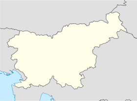
 Podvelka
